Estimated distance: 4.43 miles
Weather: 53°F, sunny
Resources: Penwood State Park, Trail Map
Highlights of the trip: view
Progress toward 2016 hiking goals: 48/52 hikes; 180.13/250 miles; 31.37/25 miles on Tunxis Trail

Another beautiful October day! It has been almost a year since I have been to Penwood, and with the foliage starting to show, I figured it was time for another trip. Last time, I thought I had hiked 6.5 miles, but since I took the same route today and it was under 5 miles, I was obviously mistaken. I think I used the trail map to figure mileage last time and must have double counted the stretch along the Metacomet.
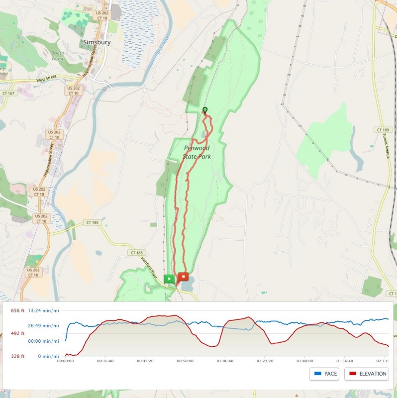
The above map comes from my MapMyHike app. I wish I could get a screenshot zoomed in closer, but then I don't get the whole map. I like the detail that the OpenStreetMap provides, but as far as I can tell, I do not have the option to view it that way while I am hiking. Once I get home and check the hike on the computer, I can change the map options to OpenStreetMap.
 |
| Along the Metacomet Trail. |
Part way along the Metacomet Trail, there is a little area off to the side where people have stacked rocks. It is really interesting. I believe there are little notes tucked in between some of the rocks in remembrance of loved ones.

The trail took me down to the road (closed to cars) near Lake Louise.

From Lake Louise, I continued on the Metacomet and climbed the "stairs" up to the Pinnacle. The view up here is tremendous. Looking south along the ridge, I could see the Heublein Tower in nearby Talcott Mountain State Park. To the left of that, I could make out a series of hills in the distance. It was funny, but my PeakFinder app wasn't labeling all of them. From west to east, I think I was seeing Lamentation Mountain, Beseck Mountain, and Mount Higby. Not 100 percent sure, but that's my guess.
 |
| Looking south at Talcott Mountain and the Heublein Tower. |
I took the road down from the Pinnacle and continued to follow it past Lake Louise and around the west side of the park. I left the road to go a short distance on the yellow trail which also offered some nice views of the valley.

I recommend taking the Metacomet, at least in one direction, to avoid some of the "crowds". The parking lot was pretty full when I arrived and jam-packed when I got back, with people parked up on the grass. I saw only two people while I was on the Metacomet and only a couple more at the Pinnacle. Along the road and yellow trail, I saw quite a few more, but the vast majority of people must keep to the road on the east side of the park.
A very nice hike, and one that I should do more often.
No comments:
Post a Comment