Estimated distance: 2.70 miles
Weather: 62°F, sunny
Resources: Granby Land Trust's Mary Edwards Mountain Property, Godard Preserve
Highlights of the trip: views, fungi
Progress toward 2016 hiking goals: 46/52 hikes; 172.36/250 miles; 31.37/25 miles on Tunxis Trail

I have to take advantage of these beautiful October days! Today I decided to go to the Granby Land Trust's Mary Edwards Mountain Property and nearby Godard Preserve. My plan had been to start at the top of the hill in Mary Edwards, go over to Godard and then continue with the Mary Edwards loop on the way back. Things didn't really work out that way.

 |
| The always spectacular view from Mary's Rock. |
As I was leaving the Mary Edwards Property, just before crossing Donahue Road to go over to the Godard Preserve, I saw this trail map at a kiosk. This map could be a little confusing to people who are not familiar with the property since it seems to indicate you are up on Mountain Road. Note, you are not at #4, you are at #1!

And while we are on the subject of trail maps, I just want to take a moment to point out something that bugs me about the maps for the two properties. If you do as I did, and print copies to take with you, please realize that they are not oriented in the same direction. The Mary Edwards map has no "north" arrow indicated, but the top of the page is generally north. The Godard map, does have an arrow indicating north, but it is pointing to the bottom of the page. Confusing for two properties that are connecting.
 |
| Mary Edwards and Godard maps. |
I played around a little and the following image is of the two maps oriented in generally the same direction. Doesn't this make things much easier to follow? I know, whine, whine, whine.
 |
| Mary Edwards and Godard property maps with the same north orientation. |
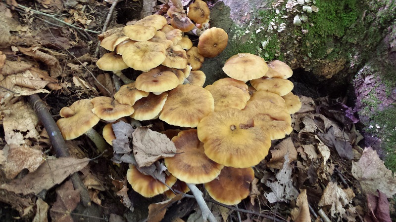
You have to put up with more mushroom pictures today, too.
 |
| Witches butter. |
 |
| Absolutely no water. |
 |
| The three leaves of the sassafras tree - single lobe, mitten, triple. |
 |
| Glacial erratic. |
 |
| Pholiota of some type. |
 |
| Sulphur Shelf or Chicken Mushroom Laetiporus sulphureus |
 |
| There are lots of stone walls. |


This was a nice hike. I used up a little too much mental energy trying to decipher the Godard map (I'd like some indication of bridges on the map, too), but now that I have done it, I should be able to add the Mary Edwards loop, too.
Eleven inch deficit? Wow. You need a hurricane sitting comfortably offshore for a while. I think we got seven inches in less than a day.
ReplyDelete