Monday, May 13, 2013

Southwestern Utah Vacation - Day 4: Bryce Canyon and Back to Zion

Thursday, April 18, 2013
Bryce Canyon National Park

Today we awoke to a beautiful, sunny day.  Granted, still quite cold, but we'll take it.

One thing I forgot to mentioned in the previous post is that we came up with a name for our rental van.  After enduring the brutal winds and freezing cold on Wednesday, we named the van "Zion" for "place of refuge".

This morning, we headed toward the park, but stopped first at Fairyland Point.  There is an 8.2 mile loop trail that starts here, but that was not on our agenda.  Instead, we ventured a short distance down the trail, just to get a little closer to the hoodoos, those strange rock spires that Bryce is known for.

View at Fairyland Point.

One of the first things we noticed was the...mud.  I guess that is what I will call it.  When you looked at the ground, it looked like little pebbles or clumps of sand that had eroded from the canyon.  Once you stepped on it though, you found it was this really gloppy mess that stuck to your boots like glue.  The more steps you took, the thicker it got, until you felt like you had another pair of shoes on your shoes.  The stuff just did not come off!  It also made the trail rather slick, and this may be why the ranger had told us he had heard that people had been falling yesterday.  I thought it was due to ice.  Now, I think it was because of this mud.

When we got back to the car, we used extra precautions to keep it clean.  There is a sticker on the window warning us of extra charges if the car is excessively dirty.  So, Dave and I flipped over our floor mats to the rubber side and the boys used plastic bags and newspapers to keep the area under their feet clean.

Mud?


Bill has an extra layer of sole.

Next stop was the Visitor Center to talk with the ranger about doing the Navajo/Queen's Garden loop.  We had been dissuaded from doing it yesterday, which was fine, but we only had today and I wanted to get into the canyon.  While waiting at the counter, who do you think we ran into again?  Yes, our friends from Vermont.  They ignored the ranger and did the Queen's Garden Loop on Wednesday and said it was really beautiful with the snow.

Today, there was a different ranger and she seemed to have no qualms about people going into the canyon.  She suggested a different route, though.  One that she preferred.  She suggested the Navajo/Peekaboo Combination Loop and said we could even add the Queen's Garden if we wanted on our way back.  The Peekaboo Loop is a 3-mile loop that is also one of the horse trails.  It takes you into the heart of the Bryce Amphitheater.  Our friends from Vermont listened in, but they decided to do the Fairyland Loop today.  They have another day here and will do Peekaboo tomorrow.

We headed down the trail for the Navajo Loop that starts at Sunset Point.  The Wall Street section of the trail is closed, so you can't actually make a loop out of this right now.  You have to either go up the same way you went down, or continue to another trail.

The trail switchbacks down to the bottom.  It still amazes me to see what some people are wearing on the trail.  I'm not saying they need to be all decked out in hiking gear if they are just going down this little section of trail, but some don't even have sneakers on.  Some of the women were wearing flats or I swear one woman was wearing espadrilles.  The mud wasn't as bad as at Fairyland Point, but her shoes still must have been completely ruined.

Down the switchbacks of the Navajo Loop trail.

Me and my benchmarks, though this is on a sign post
rather than embedded in the rock.

When we got to the bottom, we decided to take the short spur over to the Wall Street area that was closed. You could look up through the slot, but there were signs warning you to go no farther.  There looked like there was fallen rock.

Near Wall Street.

Closed.  Though it looks like the steps were blocked,
I don't think they were.
We walked back, crossed a wash, and found the start of the Peekaboo Loop.  Most people stop at the bottom of the Navajo Loop and then just return to the top, so we had most of the Peekaboo Loop to ourselves.  Although we saw evidence of horses, we didn't actually see any on the trail.

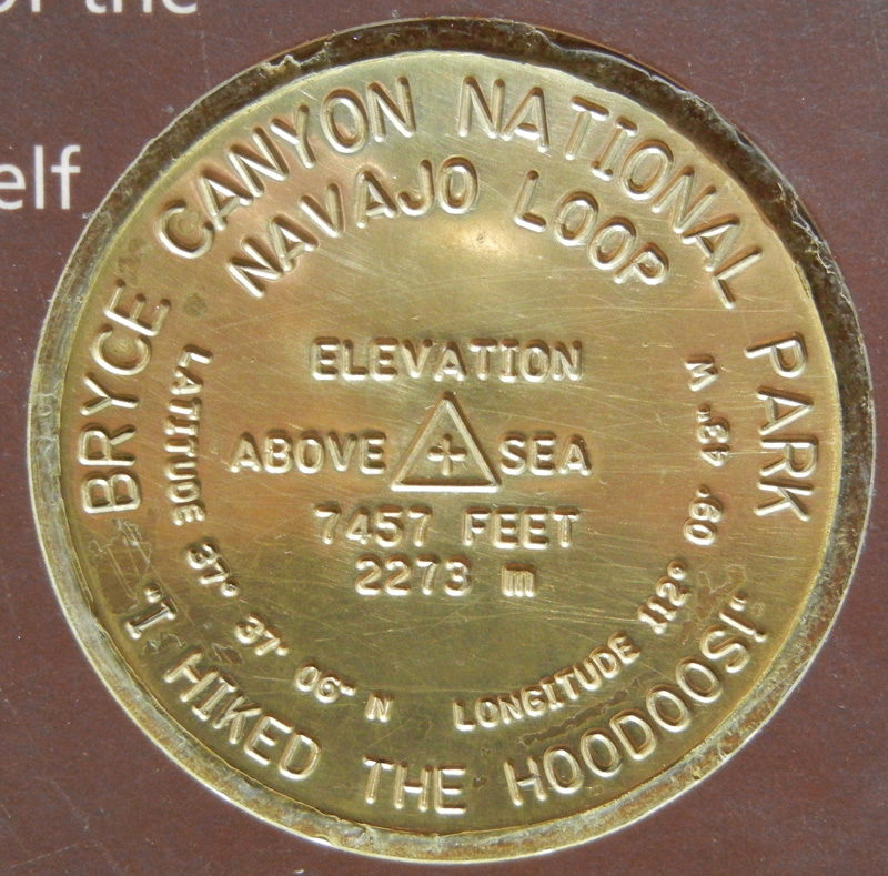
I think these benchmarks were part of some Junior Ranger Activity. 
You had to collect 3 to prove you hiked the hoodoos.


Steller's Jay chick.  We thought it was alone at first,
but then mom came back and made herself known.

In one area, we came to a trail that connected with Bryce Point.  We had been there yesterday and had seen what is called the Wall of Windows - arches cut in the hoodoos.  Now we were below those windows looking up.


Wall of Windows.

The Peekaboo Loop is listed as strenuous, but if I can do it, anyone can.  It just has a lot of up and downs and is one of those trails where you think you have made it to the top, only to realize that it goes back down and then up again!  About half-way around the loop, we came to a place where they water the horses and have an outhouse - thank goodness!  Even on the way down the Navajo Trail, two miles ago, I had been wishing that I had not had my usual mug of tea for breakfast.  Although I had been enjoying the hike thus far, I had also been spending some time contemplating where I could steal away for a pit stop.  It's hard to tell where there is a secluded spot because you have to remember there are people on the overlooks above you.  Anyway, relief!  (TMI, I am sure.)

The hike was spectacular, and again, I emphasize listening to what the rangers suggest.  They really know their stuff.  By the time we got back to the bottom of the Navajo Trail, no one was that interested in continuing on the Queen's Garden Loop.  That was fine with me.  My main goal had been to get us down below the rim of the canyon and in among the hoodoos and we had accomplished that.  In all, with the spur to Wall Street, we had hiked over 5 miles.

We ate lunch at the Bryce Canyon Lodge (no view over the canyon) and just made it in before they shut down at 3 o'clock.  Afterward, we got on the road back to Zion and were in Springdale by 5:30.  We got the same room we had at the beginning of the week.  Dave and Billy went to use the pool and the hot tub and then we went to dinner at Casa de Amigos.  The food was okay, but not fantastic. I ordered a Margarita and was told that due to state liquor law, if I wanted it frozen, it could only have one shot of alcohol in it.  I guess if I had it on the rocks, I could have two, but doing a quick Google search makes me wonder about that.  It seems like maybe they could make me a Margarita with one shot and then they would have to bring the other on the side.  Although, something else I read made it seem like they could not bring me tequila on the side, it would have to be some other liquor.  Crazy Utah liquor law looks like a fun topic to explore further, but I won't.

Desert bighorn sheep by the side of the road as we waited to go through
the Zion-Mt. Carmel tunnel on our way back to Springdale.


Monday, May 6, 2013

Southwestern Utah Vacation: Over to Bryce Canyon

Wednesday, April 17, 2013
Zion National Park
Bryce Canyon National Park

Today, we are headed over to Bryce Canyon National Park.  We will knock one of our Zion hikes, the Canyon Overlook Trail, off the list as we make our way there.

On the way out of Zion, headed east on the Zion-Mount Carmel Highway (Route 9), there are a series of switchbacks up the canyon to reach the top of the plateau.  One of the most notable features is the Great Arch, a blind or inset arch.  It has a rock headwall and is not "see through".

The Great Arch.

The next notable feature is the Zion-Mount Carmel Tunnel.  Built between 1927 and 1930, the tunnel is just over one mile long.  There are several galleries/windows that provide light, but you'll just have to take a quick look at them as you drive by because you are not allowed to stop in the tunnel.  (From what I have read, there used to be parking spaces near the galleries). Since 1989, trucks and RVs have had to be "escorted" through the tunnel.  What this means is that traffic is stopped and the tunnel becomes one way until the large vehicle (and the cars that are behind it) make their way through.  It looked to me like the system that has been worked out involves a baton.  The ranger on one end of the tunnel, gives the last car in the line behind the truck a baton.  When that car makes it through the tunnel, they hand the baton off to the ranger at the other end and he knows that the last car has come through.

Dump truck coming through the tunnel.

After passing through the tunnel, there are two very small parking areas for the trail-head for the Canyon Overlook Trail.  This easy one-mile hike took us to the overlook for Pine Creek Canyon and the lower part of Zion Canyon.  We again ran into our friends from Vermont and exchanged picture-taking assistance.

Interesting rock formations.

Pine Creek Canyon.

The guys pose for me.
 
Our Vermont friends out on that rock outcrop.

View of lower end of Zion Canyon.  We are standing over the Great Arch.
Champion of the World!


Upon our return to the car, we found that people were looking at some Desert Bighorn Sheep.


King of the mountain.

We stopped again before we left Zion to take some pictures of Checkerboard Mesa.  The horizontal lines were created by layers of ancient sand dunes.  The vertical lines were created by the freeze-thaw cycle.

Checkerboard Mesa.

As we got closer to Bryce Canyon, we could see snow falling off to our east (the direction we were headed).  In the Red Canyon area of the Dixie National Forest, the temperature outside the car was down to 25°F.  With the windchill, it was closer to 15°F.

Snow up on the plateau between Zion and Bryce.

We paid another $25 National Park entrance fee and made our way to the Visitor Center.  One of the hikes I was most interested in doing here was the Queens Garden/Navajo Loop Trail.  We checked in with the ranger to find out about conditions.  It was cold, windy and there were snow squalls.  The ranger told us that he had heard that a number of people had fallen on the trail.  Given the weather and trail conditions, and the fact that tomorrow's weather looked like it was going to improve, we instead decided to drive to the end of the canyon at Rainbow Point and make our way back, stopping at each of the viewpoints.

Boy, that wind was brutal.  We had planned on doing a couple of short paths at some of the viewpoints, like the Bristlecone Loop at Rainbow Point, but we quickly changed our minds.  We got out, took a few pictures and bee-lined it back to the car.  At some overlooks, the view was obscured by wind-driven snow.  At others, the clouds would be blown away revealing the panorama.

Looks like a nice sunny day, doesn't it?


It's snowing in the distance.

View from Bryce Point.

I like collecting pictures of benchmarks.

At Inspiration Point, which actually has three different viewpoints, a woman said it was definitely worth the climb to the farthest and highest viewpoint.  I decided to climb to that point first and visit the other viewpoints on my way down.  I am glad I did because I got a beautiful view of the Bryce Amphitheater.  Bill, who stopped along the way and arrived several minutes after me was greeted with lots of clouds, wind, and snow.

My view from Inspiration Point.

What it looked like when Bill got there a few minutes later.

Headed to hotel, we saw a group of deer in the woods.
 By now it was nearly 5 o'clock and we decided to check into our hotel.  We were staying at the Best Western Plus Bryce Canyon Grand Hotel (that's a mouthful).  This hotel seems to be brand new and is right across the street from Ruby's, one of the few places to eat, especially if you are here off season.  (Ruby's is also a Best Western, but quite a bit older).  Our hotel also had a breakfast buffet which, had we not had the one in Zion, probably would have seemed good.  It was so-so in comparison.  Our room at this hotel was more spacious, and the price was better, but no real view to speak of.  When we got to the hotel, the wind was whipping the snow completely horizontal.  It felt good to get inside.

We went to dinner that night at Ruby's.  They certainly have the market cornered.  The guys all had the (rather expensive) buffet and I had a burger which was very disappointing.  Thank goodness we only had to have one meal here.

Friday, May 3, 2013

Southwestern Utah Vacation - Day 2: Rain, Snow, and Riverside Walk

Tuesday, April 16, 2013
Zion National Park

There were a number of trails I had in mind to hike while we were at Zion.  Yesterday, we had knocked one off the list (Angels Landing).  I also wanted to do the Riverside Walk, Emerald Pools, Hidden Canyon, Canyon Overlook, and Watchman Trail.  We really only had two full days left in Zion - today and then Friday when we returned from Bryce Canyon.  Was that enough time to fit them all in?

Today the weather was not pleasant.  It was rainy and cool.  I think raw might be the right word.  We thought we would start things off by visiting the Human History Museum in the park, but found when we got there at 9:20 that it didn't open for another 40 minutes.  So we headed back to the Visitor Center to talk with a ranger and see if they had any recommendations for rainy-day trails.

We left the Visitor Center with the idea that we could do the Emerald Pools.  However, the closer we got to the shuttle stop, the heavier the rain seemed to get.  We changed our plans and decided to stay on the shuttle and get off at the last stop, the Temple of Sinawava.  Here we could take the easy mile-long paved trail to the area of the Virgin River where the hike for the Narrows starts.  I think the Narrows would be a great hike because you hike in the river, up through the canyon.  Not something that was really on the agenda for us in April, though.  The water is cold and the current is fairly strong.

The scenery here is stunning as the sheer sandstone cliffs rise a thousand feet above the river that carved them.


Looking up into the narrows.


We were all pretty wet and cold by the time we made it back to the shuttle.  As we headed back down canyon it started to snow!  A group of four that had just finished hiking Emerald Pools got on at one of the stops.  They were soaked and their hands were frozen from holding on to their hiking poles.  They were pumped, though, partly from running to catch the shuttle and partly because just as they got to the waterfall, it had started to snow and made the most amazing scene.  I'm glad we didn't go on that hike, but I love how you can still have a great experience even if the weather isn't what you were hoping.

These people we met on the bus were from the Burlington, Vermont area and we kept bumping into them all week - on other hikes, at Bryce Canyon, and finally at the airport in Las Vegas.  We compared notes on different hikes and laughed at the weather.  One of the women said she recognized us from the hotel restaurant because she remembered the nice family with the big, tall boy who still hugged his dad.

After getting dried off and warmed up a bit at the hotel, we went out for lunch.  I wanted to try out Oscar's, and luckily there was a table available inside.  There were tables outside under heaters, but that would not have done it for me.  The food was good and Bill was able to get the burger he craved.

There were breaks in the clouds in the afternoon, so we thought we'd try again for Emerald Pools.  We got to the Human History Museum and it started to rain.  We poked around in the gift shop and watched the film in the theater, but things weren't looking any better.  We did run into the Vermonters again here.

The weather cut our hiking short, but did give us some nice pictures of snow-dusted peaks.


We gave up and headed back into town.  We hit a few rock shops, went back to the hotel and eventually out to dinner.  This time we ate at Zion Pizza & Noodle Co.  It was good, but the main dining area was essentially outside.  I hadn't realized that when we walked in.  They had the shades pulled down over the "windows", but after a few minutes I realized that there really were no windows.  That explained the gas heaters positioned around the room.  I kept my coat on through dinner, but the food was good.

Thursday, May 2, 2013

Southwestern Utah Vacation - Day 1: Angels Landing

Monday, April 15, 2013
Zion National Park


After our breakfast buffet at the Switchback Restaurant (I can not emphasize enough what a highlight this was for the boys) we headed into the park.  The entrance fee is $25/car and is good for seven days.*

One of the first things we do when we get to a National Park is check out the Visitor Center and talk with a ranger.  The Visitor Center is the place to find out weather conditions, get a summary of the geology or history of the park, and get information on hiking and other sites to see.  The rangers' insights can be invaluable.

Today, the weather was a little cloudy and breezy, but not too cold.  It looked like rain was likely tomorrow, so it made sense to save shorter hikes for then.  The hike that I had in the back of my mind for today was Angels Landing, a four-hour, 5.4 mile hike that was listed as strenuous and (here is the part that gave me pause) not for anyone fearful of heights.

Here is a description from zionnational-park.com (not the official government website):
The last half-mile is across a narrow sandstone ridge. Anchored support chains are attached along some sections of the sheer fin. Sheer cliffs at high elevations while hiking on a narrow fin. Not suggested for children or those with a fear of heights. Avoid standing near the edge at all times! Do not hike the trail when it is wet, storming, or when high winds are present.

Sounds exciting, but maybe a bit too exciting.  In talking with the ranger, we found that there was an area called Scout Lookout just short of Angels Landing that still gave commanding views.  The decision was made!

We took the shuttle to The Grotto stop.  During the ride, we listened to the recorded tour of the canyon, which included an admonition that the hike to Angels Landing could be dangerous.   After exiting the bus, we crossed the road and were met by a sign warning of the danger.  The main message being "Your safety is your responsibility."  Know your limits.  I appreciate that the park service has not closed these trails, but instead has given ample warning and let people make up their own minds.

Reason enough for mom to be nervous:
Six people have gone over the edge in the past 9 years.


Crossed the Virgin River to start our hike.
The way up to Scout Lookout took some work, at least for me, but we weren't in any rush.  The guys would go on ahead and then wait until I caught up.  This part of the trail was wide and in no way scary.  Bill annoyed Tom by taking a million pictures, so any that include Tom usually show him looking exasperated.  It was becoming clear as we walked that, although Dave had no intention of going all the way to Angels Landing and I was on the fence, Tom had determined he was going to go.

Going up Walter's Wiggles
We made it up Walter's Wiggles, a series of short switchback's just below Scout Lookout.  Once at Scout Lookout, we could see across to Angels Landing.  What is not obvious from this vantage point is that the trail goes up to a peak, then back down along a narrow spine, and back up again to the end.

Spine between two peaks not visible.
The boys were ahead of us as we approached the first set of chains.  I got to the top and Tom had already continued on beyond where we could see him and certainly beyond where Dave had planned on going.  

Up the first set of chains.  Note the warning sign again.
Bill was within view and speaking distance and was planning to follow Tom.  I hadn't really made up my mind that I was okay with them going and at least wanted to talk it over with them, but it was out of my hands now.  I was certain that I couldn't follow them and watch them on the scary parts, though.  So I stayed at Scout Landing, a nervous wreck, for the next hour or more.  (Let me just say I'm glad I hadn't read this article before we went.)

Bill took this picture looking back at us.  My comment was,
"Put the camera away and hold onto the chain with both hands!"
The time that they were gone seemed like forever.  Neither of us had realized that the trail continued as far as it did.  As I mentioned previously, you can not see the part of the trail that dips down between the two peaks, so it doesn't seem like it should take that long.  The time was spent alternately between thinking terrible thoughts and being distracted by other people who were going by or had joined us at this place that was deemed "far enough".

The narrow part we couldn't see.
Tom scrambling up.
The view from the top.
Tom taking a picture over the side with the phone.
What a relief when the boys came back into view!  They had made it all the way to the end.  I think I was more proud of them than they were of themselves.  Just another day for a kid, I guess.  I am glad I did not go with them, because I think I would have ruined the experience for them. 

Back down Walter's Wiggles.
A picture of the trail from above.
A great view of the canyon.
I can't vouch for the trail all the way to Angels Landing, but if I can make it to Scout Lookout, most other people can to.  It is well worth the trip.

After the hike, we headed back into town and ate a very late lunch at Cafe Soleil.  Yummy paninis and some pizza.  Definitely hit the spot after our long hike.  From there, we went back to rest at the hotel.  The guys played on the putting green a bit and then Bill and Dave went for a swim in the heated pool.  I just enjoyed the view from a rocking chair on the back patio.

Later we learned about the bombings at the Boston Marathon.  It felt odd to be so far from home.


*  If you walk into the park, the fee is $12/person and is free for those age 15 and under.  Our teenagers are 15 and 14, so we could have saved a whole dollar by walking in.  If you are going to use the shuttle, there is no need to drive in.  We were going to be driving over to Bryce and would need to go through Zion on Route 9 to do so, so paying for the car for the week made sense anyway.  I did walk into the park by myself once and simply had to show the receipt.  If we were trying to enter the park at different times and meet up somewhere else later, I don't know how you would handle that as there is only one receipt.