Saturday, January 30, 2016

Hike #9: Northwest Park - Windsor, CT

Date Hiked:  Saturday, January 30, 2016
Estimated distance round-trip: 6.01 miles
Weather: 34°F, sunny
Resources: Northwest Park, Trail Map
Highlights of the trip: bald eagle, ice sounds
Progress toward 2016 hiking goals:  9/52 hikes; 29.35/250 miles


As much as I love McLean Game Refuge, it was time for a change.  I decided on Northwest Park in Windsor.  It's relatively close by and not too difficult.  I was pleasantly surprised that I could get in six miles of hiking there!


On my way to the park, I saw a sign at the rotary on Prospect Hill Road indicating some kind of event at the park today.  I couldn't find anything about it on their website, but there is a Northwest Park Meetup and that indicates that it is the annual Cabin Fever (Winter Festival).  There was supposed to be a bunch of snow activities like snowball throwing and miniature snowman making, plus skis and snowshoes to rent.  The festival still took place (I could see the bonfire going as I was leaving), but the snow activities will have to wait for another day.


Ski rentals to the left, nature museum straight ahead.
I made a quick pit stop in the nature museum before I hit the trails.  I had forgotten what a nice little museum that is.

Woodpecker sculpture outside museum.  See the chicks in the tree cavity?
From the museum, I headed west toward the reservoir.  Just before getting to the reservoir, there is a small beaver pond.  There was ice over the pond, and I got to hear that spooky ice sound again.  I imagine it could be pretty disconcerting if you didn't know what it was.

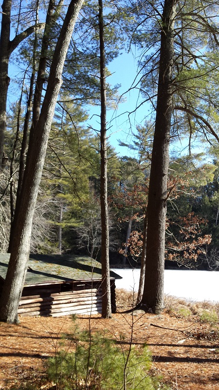
Beaver pond.  Lodge is in the middle of the picture in front of the tall pines.

Signs of beaver activity.

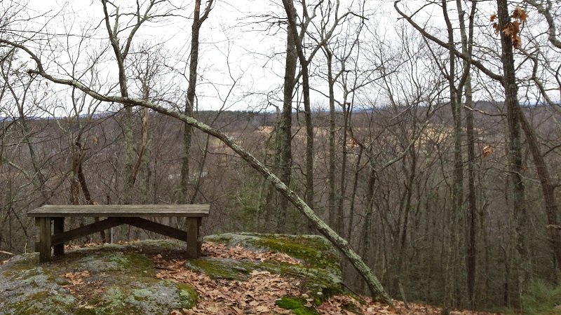
Looking north up the reservoir from an old abutment.

Beaver pond again.

Backtracking, I picked up the Wetland Forest (yellow) trail north along the edge of the reservoir until it joined the Rainbow Reservoir (pink) trail.  A bald eagle flew in the opposite direction along the edge of the reservoir

Along the Wetland Forest Trail.

Fungi can be very beautiful.
The Rainbow Reservoir Trail heads in away from the water along a ravine until it connects with the Triassic (black) trail.  I didn't give the name of the trail much thought, but it turns out that there is a large fossil footprint of a dinosaur, specifically Eubrontes (a Jurassic dinosaur), on display along the trail.  This fossil was given to the park by Dinosaur State Park in Rocky Hill, however an article I read indicates that there were Triassic era fossil footprints found in along the reservoir in 1936 and identified in 1981 as Coelophysis.


Eubrontes fossil footprint.

The black trail leads back out toward the reservoir and I took a little side trail down to see the dam.  There is chain link along here with no trespassing signs, so you can't get too close.

Rainbow Reservoir Dam
I continued around a large field with old tobacco barns.  I saw a couple of raptors circling in the sky overhead, but I could not identify them.


I turned again and made my way down a path that led to the Open Forest (green) trail.  This trail backs to some homes, so I was happy to leave it.  I continued back toward the museum building, but then took Brookside (purple) Trail into the woods.  This trail has markers for plant identification, but spring may be the best time to see many of them.

I ended my hike by stopping by the animal barn.  There were sheep, goats, ducks, turkeys and a donkey.


People had started to arrive for the Winter Festival.  I did not walk over to see what was going on, but the bonfire had already been lit.

Bonfire for Winter Carnival.

Finally!  A hike of over 5 miles!  When I set my hiking goals, I chose 52 hikes because a hike a week seemed reasonable.  I know there will be weeks I won't be able to hike, so when I can I need to do more than one a week.  I also set a goal of 250 miles which means I need to hike at least 5 miles on each of those hikes.  So far, my hikes have all been under 5 miles, but I am also averaging more than a hike per week.  Let's see if I can keep the momentum going.


Wednesday, January 27, 2016

Hike #8: McLean Game Refuge - Granby, CT

Date Hiked:  Wednesday, January 27, 2016
Estimated distance round-trip: 2.89 miles
Weather: 40°F, sunny
Resources:  McLean Game Refuge, Refuge Map
Highlights of the trip:
Progress toward 2016 hiking goals:  8/52 hikes; 23.34/250 miles


Monday, January 25, 2016

Hike #7: McLean Game Refuge - Granby, CT

Date Hiked:  Monday, January 25, 2016
Estimated distance round-trip: 2.86 miles
Weather: 35°F, sunny
Resources:  McLean Game Refuge, Refuge Map
Highlights of the trip: ice sounds
Progress toward 2016 hiking goals:  7/52 hikes; 20.45/250 miles


Not too much to report.  It was a beautiful day, so I decided to do a short hike before lunch.  The trails had a dusting of snow on them, but that was about it.  The kids were sorely disappointed we didn't get more.

The game refuge is a fairly common hiking spot for me.  I love being out in the woods and it is always beautiful, but because I hike here so often, I find it hard to come up with something unique to comment on.  Well today, I didn't see something unique, but I did hear something a bit unusual.  I'm not really sure how to describe it other than to say it was almost other-worldly.  As I came down the hill toward Spring Pond, I heard this bizarre twanging (not really the right word) noise.  I assumed it was something that was going on farther away - some construction site noise or something.  When I got down to the pond, I heard it again.  It was definitely coming from the pond.  I decided it was the ice shifting.  There would be a loud noise and then it would echo around the pond which is surrounded on three sides by hills.


Here is a video that someone else made that captures the sound I heard. 

Lower Sardine Ice Cracking or, as I like to think of it, alien ice sounds:  YouTube video


Saturday, January 23, 2016

Hike #6: Robinson State Park - Agawam, MA

Date Hiked:  Saturday, January 23, 2016
Estimated distance round-trip: 4.18 miles
Weather: 27°F, cloudy
Resources:  Robinson State Park, Trail Map
Highlights of the trip: dam
Progress toward 2016 hiking goals:  6/52 hikes; 17.59/250 miles


A couple of friends who live outside of Boston were heading to western MA to do some cross country skiing and asked if we wanted to get together.  We were a little leery of going too far from home with a Nor'easter bearing down on the region, but weather reports seemed to indicate the worst weather would be to our south.   We decided to meet them for a hike at Robinson State Park in Agawam, MA.

We parked right near the main entrance.  The state website indicates a parking fee, but that may only be for the warmer months.  The gatehouse was boarded up.  The road into the park remained open, but there were signs all over the place making it clear that the gates would be closed at 4 p.m.  We headed into the eastern part of the park and walked along the Westfield River. 


Freight train moving along the other side of the river.


Interesting ice.

The most spectacular part of the hike was the ice covering the West Springfield dam.


Looking across the dam to the fishway.

I'm glad we decided to hike along the river in this direction because the dam was really interesting.  I'm also glad we got out here on a cold January day.  This isn't something you would see at other times of year.

After our hike, we had lunch at American Classics which was only about 1/2 mile away.  The decor is nothing special, but the food was good.  I had a BLT and onion rings.  The onion rings were really good and I thought I got a good size helping for the price.  One friend had blueberry pancakes with real maple syrup and the others had chili which, though made with ground beef as opposed to chunks of meat, had very good flavor.  If it were a little closer to home, we would probably make it a regular place to eat.

A good morning of hiking and catching up with friends we hadn't seen in a couple of years, then back home to wait for the snow.

Hike #5: Holcomb Farm Full Moon Hike - Granby, CT


Date Hiked:  Friday, January 22, 2016
Estimated distance round-trip: 1.16 miles
Weather: 27°F, cloudy
Resources:  Holcomb Farm, Trail Map
Highlights of the trip: night hike
Progress toward 2016 hiking goals:  5/52 hikes; 13.41/250 miles


Last year at this time, I went on a full moon snowshoe hike at the farm.  There is no snow for snowshoeing this year, although there is a big storm working its way up the coast this weekend.

The hike was billed as a full moon hike to look for owls.  About 60 people had signed up.  We crossed Simsbury Road to the east side of the farm and climbed to the fields at the top of the hill.  We split into several groups and went in different directions.  I was in a small group with a young family.  The kids were good and whenever we stopped to listen for owls, they kept quiet.

We didn't have much luck with the owls, but I enjoyed being out hiking in the dark.  I'm hoping that they'll schedule another full moon hike and maybe I'll see if a couple friends will join me.

We didn't hike much more than a mile, but I'm counting it toward my goal since it was a hike that was a little different than the norm.

Sunday, January 17, 2016

Hike #4: Holcomb Farm Western Trails - Granby, CT

Date Hiked:  Sunday, January 17, 2016
Estimated distance round-trip: 3.45 miles
Weather: 33°F, cloudy
Resources:  Holcomb Farm, Trail Map
Highlights of the trip: streams
Progress toward 2016 hiking goals:  4/52 hikes; 12.25/250 miles


We got a little snow the other day, but it rained yesterday and the trails were completely clear.  


Trail Map of Holcomb Farm's western trails

I decided to hike the trails on the western side of Holcomb Farm.  After crossing the CSA field and the bridge over the West Branch of Salmon Brook, I followed the yellow trail to the north.  Just before the staircase, I took a white blazed trail over to the brook.  After yesterday's rain, the water is running pretty well.  There is a LOT of debris along the banks.  Some are very large trees.  Just shows the power of the water when it floods.


I took the white trail up to the blue trail which went north for a little while before heading south.  I followed this to the green trail which I took north again and to the purple trail which took me back south (my zigzag).

Overlook from the purple trail.  Can see the fields on the east side of the farm through the trees.
At the southern end of the trail system, the Holcomb Farm Property abuts the McLean Game Refuge.  Beach Brook is running down the hill, and I went off the trail a bit to take a look at it.

Beach Brook
I returned to the trail and walked through the area where the kids from Two Coyotes have built some wigwams.


I continued across the bridge on the yellow trail.  I loved the ice hanging from the leaves over the brook.


Given the rain yesterday, I was pretty sure I wouldn't be able to traverse the brook to stay on the yellow trail, but I decided to take a look.  There is no bridge at the second crossing, just a rope to hold on to to help you balance as you pick your way over the rocks.  Maybe (unlikely) I could have crossed the first part, but definitely not the second part where there is no rope.


I turned around and headed back the other way on the yellow trail.  I climbed to another little overlook with benches around a fire pit, and north to the stairs that took me back down to the bridge I crossed when I started the hike.  Back across the CSA field and to the farm.


I'm happy with the progress I am making toward my goal of 52 hikes in 2016.  I've been lucky with the weather.  I am a little worried about the mileage goal.  I need to be averaging 5 miles per hike and I am usually at least a mile under.  I'll have to plan some longer hikes as I go forward.


Sunday, January 10, 2016

Hike #3: McLean Game Refuge - Granby, CT

Date Hiked:  Saturday, January 9, 2016
Estimated distance round-trip: 4.01 miles
Weather: 40°F, cloudy
Resources:  McLean Game Refuge, Refuge Map
Highlights of the trip: ice formations
Progress toward 2016 hiking goals:  3/52 hikes; 8.8/250 miles

We have much needed rain today, so I'm glad I got out for awhile yesterday.  I did a counter-clockwise loop at McLean Game Refuge starting at the entrance on Canton Road.  There is room for a few cars there along the side of the road.


The ice formations I found along Bissell Brook were pretty interesting.  The ones running along the logs were like the petals on a flower or, maybe more appropriately, like giant snowflakes.


It probably doesn't show very well in the picture below, but the little bubbles under the ice were beautiful, like little jewels.


Over at Kettle Pond, the lack rain is evident. The place I stood to take the next two pictures would normally be under water.  In the spring, I like to come to Kettle Pond to look for newts and wood frogs.  Normally, I stand at the base of the large tree you see.  One more step and I would be in the water.  Not now.


In this next picture, I turned around and took a picture of what is left of the pond.  The ground was squishy here and I could hear ice breaking under my feet as I walked.


After Kettle Pond, I went up and around a field and down the hill to Spring Pond.  I assume that the name is suggestive of the water source, so this pond was at a normal level.  The run-off goes to Bissell Brook.

The picture doesn't do it justice, but the view as you come down the hill from the field is so pretty.  Normally the water has a greenish tint that is just amazing.  Today, with a thin coat of ice on the pond, it had a different color, but still quite stunning.


I love the little log cabin under the tall pines.


I'm glad I got out on this relatively warm day, but I need to start doing more miles if I am going to reach my goal of 250 miles for the year.


Sunday, January 3, 2016

Hike #2: McLean Game Refuge - Granby, CT

Date Hiked:  Sunday, January 3, 2016
Estimated distance round-trip: 3.36 miles
Weather: 40°F, cloudy
Resources:  McLean Game Refuge, Refuge Map
Highlights of the trip: just being out in the woods, tall pines


I started this hike in the picnic grove area off of Barndoor Hills Road.  I made a counter-clockwise loop on some of the woods roads and along the Werbitzkas Loop.

Shelter in the picnic grove.


Cabin at Trout Pond.

Thin layer of ice on Trout Pond.

Field along Werbitzkas Loop.

West Branch of Salmon Brook.

West Branch of Salmon Brook.


Hike #1: Great Pond - Simsbury, CT

Date Hiked:  Friday, January 1, 2016
Estimated distance round-trip: 1.43 miles
Weather: 39°F, cloudy
Resources: Massacoe State Forest, Great Pond Trail Map
Highlights of the trip: Pileated Woodpecker, winter colors

Not a very long hike, but I wanted to accomplish something on New Year's Day.  I chose a short, level hike because I was not sure what I would find in terms of ice. There had been about an inch of snow/sleet earlier in the week and I was afraid that if it had been packed down it would be icy.  Instead, I found that there were areas that were clear and then other areas that had mushy snow.  No sheets of ice.


I headed counter-clockwise around the pond and past a couple of beaver lodges.  The pond had a skim of ice on it in some places, but had open water in others.


Winterberry against White Birch

Red Pine and Rhododendron

Shortly after passing through the Rhododendron tunnel, I saw a Pileated Woodpecker.  He was working his way up a tree at the edge of the pond.  As I fumbled around with my phone trying to get a picture, he went around the back-side of the tree.  I never did manage to get a picture of him.

Open water on the north side of the pond.
There were a number of ducks out on the open water on this side of the pond.  They flew a little farther away as I approached the shoreline. 

This was a short, quiet hike that was a good start to the new year.