Friday, October 14, 2016

Hike #46: GLT's Mary Edwards to Godard Preserve - North Granby, CT

Date Hiked: Friday, October 7, 2016
Estimated distance: 2.70 miles
Weather: 62°F, sunny
Resources:  Granby Land Trust's Mary Edwards Mountain Property, Godard Preserve
Highlights of the trip:  views, fungi
Progress toward 2016 hiking goals:  46/52 hikes; 172.36/250 miles; 31.37/25 miles on Tunxis Trail


I have to take advantage of these beautiful October days!  Today I decided to go to the Granby Land Trust's Mary Edwards Mountain Property and nearby Godard Preserve.  My plan had been to start at the top of the hill in Mary Edwards, go over to Godard and then continue with the Mary Edwards loop on the way back.  Things didn't really work out that way.


The always spectacular view from Mary's Rock.

As I was leaving the Mary Edwards Property, just before crossing Donahue Road to go over to the Godard Preserve, I saw this trail map at a kiosk.  This map could be a little confusing to people who are not familiar with the property since it seems to indicate you are up on Mountain Road.  Note, you are not at #4, you are at #1!


And while we are on the subject of trail maps, I just want to take a moment to point out something that bugs me about the maps for the two properties.  If you do as I did, and print copies to take with you, please realize that they are not oriented in the same direction.  The Mary Edwards map has no "north" arrow indicated, but the top of the page is generally north.  The Godard map, does have an arrow indicating north, but it is pointing to the bottom of the page.  Confusing for two properties that are connecting.


Mary Edwards and Godard maps.


I played around a little and the following image is of the two maps oriented in generally the same direction.  Doesn't this make things much easier to follow?  I know, whine, whine, whine.


Mary Edwards and Godard property maps with the same north orientation.


 You have to put up with more mushroom pictures today, too.


Witches butter.
This is one of the "streams" on the Godard Property.  This is what an 11-inch rainfall deficit looks like.

Absolutely no water.


The three leaves of the sassafras tree - single lobe, mitten, triple.

Glacial erratic.

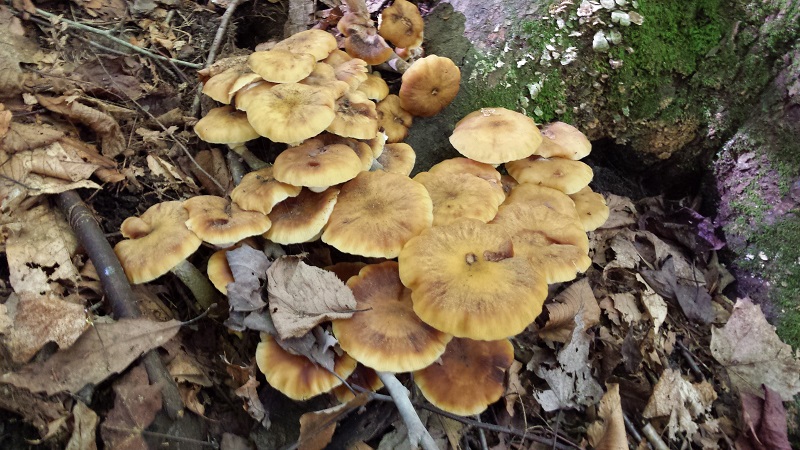
Pholiota of some type.

Sulphur Shelf or Chicken Mushroom
Laetiporus sulphureus
And back over to Mary Edwards where I have to climb back up to the top.  As I mentioned, my plan had been to complete the Mary Edwards loop, but it was lunchtime and I decided to head back.


There are lots of stone walls.


This was a nice hike.  I used up a little too much mental energy trying to decipher the Godard map (I'd like some indication of bridges on the map, too), but now that I have done it, I should be able to add the Mary Edwards loop, too.

Friday, October 7, 2016

Hike #45: McLean Game Refuge - Granby, CT

Date Hiked: Wednesday, October 5, 2016
Estimated distance: 3.46 miles
Weather: 55°F, sunny
Resources: McLean Game Refuge Trail Map
Highlights of the trip:  awesome variety of fungi, views
Progress toward 2016 hiking goals:  45/52 hikes; 169.66/250 miles; 31.37/25 miles on Tunxis Trail


I wanted to get out for a hike on this beautiful day, but since I hadn't planned ahead, I stuck with my usual trip to McLean Game Refuge.  I did decide to change my loop just a bit, figuring the highlight of the trip would be the hike to the top of the Eastern Barndoor Hill.  The view was nice, but what really made this hike great was the amazing variety of fungi I found.


Spring Pond.  The leaves are just starting to change.

The variety of mushrooms I saw in just one hike was amazing.  Colors crossed a wide spectrum - white, beige, yellow, pink, orange, and violet.  Be prepared to be bored by my many, many pictures of mushrooms.  In some cases I have guessed as to their names, but they are only guesses.


Some sort of coral fungi.


False turkey-tail fungus?

Some sort of slime mold.

Witches' Butter

Wolf's-milk Slime?

As I turned from the trail that came up from dried-up Kettle Pond, I came to this big, dead tree.  I love this tree.  So stately.  It was here that I had seen puffballs before, so I stopped to take a look.  No luck.


I continued on the trail to the summit.  Aster and goldenrod were growing along the side of the trail.


I stepped out onto the ledge so that I could look north.  It looks like that is Sodom Mountain in Southwick, MA just to the right of center.  The leaves are only just starting to change.


I walked to the second viewpoint to look out over the Western Barndoor Hill.


Spiny puffball.


Another spiny puffball?


I had been keeping my eyes out for puffballs and was rewarded with a log absolutely covered with them.  These seem relatively "fresh" in that the insides were a spongy white.  As they age, a little hole opens in the top and the insides turn to a powder of spores.  If you squeeze the puffball a little "puff of smoke" comes out.  When I was a kid, we used puffballs as mini-grenades in our war-play out in the woods.

Gem-studded puffball?


Near the beginning of my hike, when I was taking a picture of the pink slime molds, another hiker came along the trail.  He mentioned that he had seen these great big orange mushrooms back the way I had come.  I didn't feel like backtracking, and as it turns out, I didn't need to.  I came across these tremendous mushrooms later on.  They seriously looked like the color of pumpkins and I saw them from across the woods road.  Amazing!

Sulphur Shelf or Chicken Mushroom
Laetiporus sulphureus
Instead of taking the usual woods road back to the entrance, I decided to cross the stream and take the horse trail back.  I am so glad I did.  Check out the mushroom below.  It had to be at least as big as a basketball.


Hen of the Woods?


Birch polypore?
And finally, this little guy caught my eye because I noticed a flash of purple by the side of the trail.

Viscid Violet Cort (Cortinarius iodes)

It never ceases to amaze me that I can find something new and interesting on trails that I have hiked many, many times.

Tuesday, October 4, 2016

Hike #44: Broad Hill Road Area of McLean Game Refuge - Granby, CT

Date Hiked: Monday, October 3, 2016
Estimated distance: 4.93 miles
Weather: 70°F, mostly cloudy
Resources: McLean Game Refuge Trail Map, Hike #18
Highlights of the trip:  quiet woods
Progress toward 2016 hiking goals:  44/52 hikes; 166.20/250 miles; 31.37/25 miles on Tunxis Trail


I need to get some miles done if I want to make my goal of 250 miles for the year.  That means that I am going to have to do some hiking during the week.  I was trying to think of a place that I could go that would be a little different, but would not take me too far from home.  I decided I should revisit the Broad Hill area of the McLean Game Refuge.  This had been an interesting hike when I did it back in April.


My plan today was to explore a little further into the refuge on the Eddy Loop.  I parked at the gates, where Broad Hill Road turns to gravel, and walked up to Carpenter Falls.  I took a left on to the Weed Hill Trail and followed it until I got to the white-blazed Eddy Loop Trail. I decided to go out about 2.5 miles and then turn around (it was about 2.4 when I actually turned around).


Top of Carpenter Falls.

Looking south on Weed Hill Trail.

There are a lot of old stone walls here.


I was starting to wonder if I had missed the turn-off for the Eddy Loop Trail.  Then I cam across a sign post.  As I faced the post, the trail I wanted was behind me.  The rest of the trail continued in the same direction I had been going and would have taken me out on to Firetown Road.  I think to actually complete the Eddy Loop of 3.2 miles, you have a bit of walking on Firetown.


I was not going down to the road.  I turned on to the white-blazed trail.  After a short way, it seemed like I was going in the wrong direction.  I felt like I was doubling back the way I had come.  But, it is just the way the trail goes and it soon turned again to go the way I expected.  Off to my left, I could see an area that could possibly have a little waterfall when there is enough water, and before long, I crossed that stream higher up.  I crossed another stream just before I turned around.

I climbed to the top of this little ledge to turn around.

Some kind of coral fungus.

When I got back to Carpenter Falls, I climbed down below the falls to take a look.  There was not a lot to see.  If you look at the pictures I took on my hike here in April, you will see what I mean.


There were no beautiful vistas or rushing waterfalls, but I absolutely loved this hike.  I like to imagine what it must have looked like when people actually lived up here.  I think about what secrets these woods hold - old cellar holes, orchards, etc.

On future hikes, I'd like to leave a car over on the corner of Simsbury Road and Barndoor Hills Road and hike all the way through on the Eddy Loop and Firetown Trails.  I'd also like to explore where I left off in April on the Pine Cone Trail and see if I could hike all the way to Enders Falls.  There is a lot of exploring to do in this area.


Monday, October 3, 2016

Update: 2016 Hiking Goals

An update at the end of the third quarter.

1.  Take 52 hikes.  
43/52 hikes.  I need to do at least 3 hikes per month for the rest of the year.

2.  Hike for 250 miles.
161.27/250 miles.  This one has me a little nervous.  I only have 9 hikes to do, but have almost 90 miles.  I do not tend to do 10 mile hikes.  I am lucky if I do 5 miles.  Assuming I do 5 miles/hike, I have 18 hikes to do in the next 12 weeks.

3.  Hike at least 25 miles of the Tunxis Trail
31.37/25 miles.  This goal has been completed. 

4.  Visit Bash Bish Falls (Massachusetts)

5.  Hike Mount Monadnock (New Hampshire)

6.  Visit a "new-to-me" state park or forest in Massachusetts (Bash Bish does not count).
Hiked the D.A.R. State Forest in Goshen, MA on April 23.

7.  Hike on the Appalachian Trail
Completed on July 20.  Hike #38 - Lion's Head in Salisbury, CT.

I feel like I am up against the wall a bit with Bash Bish and Mt. Monadnock.  I had hoped to visit Bash Bish in combination with climbing Alander, but I might just have to do the falls and put Alander on next year's list.

Summer is not my favorite time to hike - too humid and too buggy.   I think Fall may be the best time to hike, so I hope I can make up some ground.