Showing posts with label West Simsbury. Show all posts

Wednesday, June 7, 2017

2017 Hike #18: Tulmeadow Farm to Ethel Walker Woods - Simsbury, CT

Date Hiked: Saturday, May 20, 2017
Estimated distance:  5.84 miles
Weather: 60°F, partly cloudy
Resources: Simsbury Land Trust, Tulmeadow Farm Trail Map, Ethel Walker Woods Trail Map
Highlights of the trip:  hiking with a nice group
Progress toward 2017 Outdoor Goals:  18/52 hikes; 61.78/250 miles hiked

I am way behind in my posting, so I'll keep words to a minimum.

My hiking partner and I joined Simsbury Land Trust for their May Hiking Club Hike at Tulmeadow Farm.  We hiked through Tulmeadow and its woodlot, over to Town Forest Road, and into Ethel Walker Woods.  We had a good hike with a nice group of people.  I look forward to hiking with them again in the future.


Tulmeadow Farm

I love this tree as you enter the Ethel Walker property.

Some kind of azalea.

Lady's-slipper.

I'm thinking Hemlock varnish shelf.

Fringed polygala (Gaywings), I also heard someone refer to them as Bird-on-the-wing.

Town Forest Park

Tulmeadow woodlot.


Looking across Tulmeadow Farm to West Mountain Highlands.


Wednesday, September 25, 2013

Simsbury: Hedgehog Mountain and Bog Trail

Date Hiked:  Saturday, September 14, 2013
Estimated distance round-trip: 1.5 miles in total
Weather: 67°F, beautiful and sunny
Resources:  Simsbury Land Trust
Highlights of the trip:  Views, beautiful fall colors already appearing in the bog


With a month to go before a hike up Mount Cardigan in New Hampshire, I've been trying to find some places locally that I can hike that will challenge me.  The elevation gain at Cardigan is nearly 2000 feet, and I am just not going to find that in Connecticut.  Today, I chose Hedgehog Mountain in West Simsbury.

I parked at the end of North Saddle Ridge Drive and took the white trail up along the stream and turned left onto the red trail which climbs to the top of Hedgehog Mountain.  I know this is nothing compared to what I am going to find in NH, so I decided to hike without stopping until I got to the overlook.  (That's a big deal for me.)  I think this view of the Farmington Valley is the best around.  It offers a whole different perspective than the one you get from the Metcamet Ridge on the other side.

Looking north.

Looking east.  That is the bog in the center.
On the way down, I stopped to take a few pictures.

Comon Polypody fern.


I returned to my car and drove just a short distance back down North Saddle Ridge Drive to the marker for the Bog Walk.  A short walk through the woods brought me to a boardwalk into the bog.  The colors were fantastic.


Looking at the ridge of Hedgehog Mountain.

Love the puffs of white cotton-grass in this photo.

After all the color of the bog,
the photo of the trail along the esker looks black & white.


Wednesday, August 29, 2012

West Simsbury - Hedgehog Mountain Hike

Date Hiked:  Sunday, August 26, 2012
Number in group: 3
Estimated distance round-trip: 3 miles
Weather:  Sunny, 84°F
Resources:  Simsbury Walkbook, West Mountain Trails Map
Highlights of the trip: Views

On Sunday, I went with a friend and her husband to hike the Western Mountain trails in West Simsbury.  He geocached as we hiked along.  Using the map below, you can get an idea of our route.  We started at the Master's School parking lot and hiked north along the red trail until we came to the bridge where the Hedgehog Trail joins the Cathles Trail.  Here we took the white trail west to the blue trail to return to the car.

From Simsbury Land Trust website.
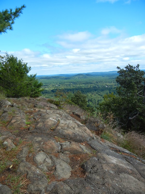
The views from the overlook on the Hedgehog Trail are some of the best around.  Unfortunately, I forgot to take a picture, so I will share one from April of 2009.

Overlook on Hedgehog Trail from April 2009.


The trail to the overlook wasn't too bad, probably because I had someone to talk to to keep my mind off of the climb.  Plus, we stopped a few times for the geocacher to look around.

After the view, we headed, down, down, down, to the bridge over the stream where the Cathles Trail starts.  Instead of turning around and going back up, up, up, we used the white trail as a cut-off over to the blue trail and took that back.

Bridge where Hedgehog and Cathles Trails meet.

The blue trail saved us from the steep ascent we would have had to make if we retraced our steps.  The trail was pretty rocky, though.  We did get a great view of the talus slope on the back side of the ridge.


Along the blue trail.

Talus slope.

The blue trail also takes you alongside the Simsbury Resevoir.  We could see it a little through the trees, but we didn't venture down to it.  The reservoir didn't look as clear as I was expecting.  It looked like it might have a bunch of lily pads or other plants, but like I said, we didn't go down to check it out.

This is really a nice hike.  It would be great to do in the fall so I may get my homeschool hiking group out there to enjoy it.