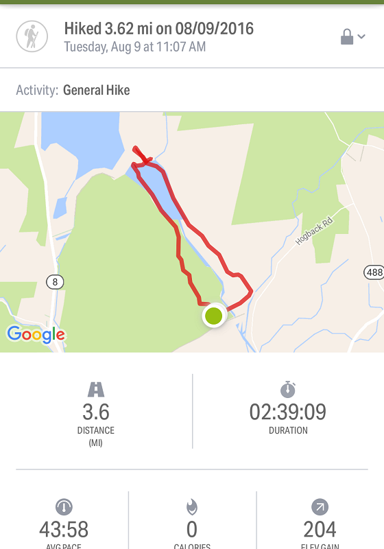
Estimated distance: 2.77 miles
Weather: 79°F, scattered clouds
Resources: Peter Marteka's Article in Hartford Courant: The Ghost Bridge and Highway of Colebrook River Lake (pub. 09/11/2016)
Highlights of the trip: bridge and road normally covered by water
Progress toward 2016 hiking goals: 41/52 hikes; 153.75/250 miles; 31.37/25 miles on Tunxis Trail
When I saw Peter Marteka's article in the Hartford Courant on Sunday, I knew where I was going to go on my next hike. Colebrook River Lake is the body of water north of the West Branch Reservoir, where my hiking partner and I kayaked in my last post. She wasn't available today, but my husband was nice enough to indulge me after returning from his golf outing.

The funny thing is that, in my last post, my app makes it look like we kayaked over dry land. This time it makes it look like we walked on water!
 |
| Colebrook River Lake Boat Launch on Google Maps |
Above is an image from Google Maps that shows the "normal" water level. See the area I marked as "Old Road"? The picture below shows people driving on the "Old Road". Crazy! (Although I read somewhere - can't remember where - that the water level may be lowered at certain times of year, for flood control, and that you may be able to access the road then.)
 |
| Old road on left and end of boat ramp on right. Picture taken from the boat launch parking area. |
 |
| Barricades up in front of boat launch for obvious reasons. |
 |
| Looking south toward the dam from the boat launch parking area. |
We could have driven down the old road to see the bridge that Marteka mentioned in his article, but we decided to walk. It was an absolutely gorgeous day and it seemed to be a better way to really grasp how low the water level really is.
 |
| Old road headed north from parking area toward bridge. |
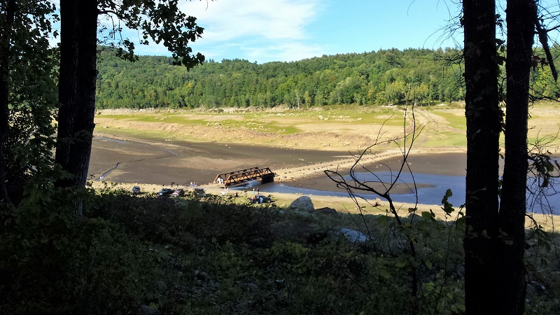
The picture above was taken from the old road looking down on the iron bridge. The water would not normally cover the road here, but it would come up much closer to the trees.
 |
| Google maps image of the area where the bridge is. You can see the road in this area is not usually under water. |
 |
| Looking north. |
 |
| Looking north. Tree stumps that remain from when the land was cleared to make way for the lake. |
If I understand the history properly, the MDC started buying up property along the West Branch of the Farmington River in the 1930's. By 1955, construction of the Goodwin Dam, at the southern end of the West Branch (Hogback) Reservoir, was complete and the planning for the Colebrook River Dam began. So, they basically divided the reservoir into two parts. You can read more about the history of the dam at the Colebrook Historical Society website and at the U.S. Army Corps of Engineers website.
 |
| Harvey Mountain Bridge with the West Branch flowing beneath. |
When we went on Sunday, we were still free to cross the bridge and walk around on the other side. It now seems that officials have closed the bridge. (Quite unlike our trip to Ireland last year where we climbed an old bunker that had decrepit steps and glass all around with no warnings at all. I guess they just expect you to use your head and/or not sue if you manage to hurt yourself. Personal responsibility - novel).


On the far side of the bridge, we saw large areas of mud flats and old stone walls. It's a little hard to comprehend that there was a town here. We did not spend a lot of time looking, but I did find a rusted piece of metal on the ground. Check out this picture from Demarsimages.com.
The flooding of this town, Colebrook River, is not unique. Barkhamsted Hollow and Hartland Hollow were both flooded for the Barkhamsted Reservoir and four towns were flooded for the Quabbin Reservoir in Massachusetts. The Hartford Courant article by David K. Leff, History Submerged: Clues to World Beneath Connecticut's Reservoirs is worth reading. (I also love the children's book Letting Swift River Go by Jane Yolen about the drowning of the towns for Quabbin).
 |
| Looking south. |

 |
| Bridge we crossed. |
I am so glad we grabbed the opportunity to visit the lake while we were still allowed to cross the bridge. You may be able to access the other side from Harvey Mountain Road or Colebrook River Road, but I have not tried it.
 |
| Colebrook River Dam. |
Here is a very cool video shot recently by a drone. Colebrook River Lake, Aerial Video Journey of Low Waters by Addy Overbeeke. When he turns the drone around and heads south, you will see the road and the bridge - all normally covered by water. This is not something that happened just over the course of this year. I found someone's blog, that had a picture of the top half of the bridge showing in 2010 and she said people were able to walk across it in 2009. In 2012, the water level was up and only the top of the bridge was showing. In 2015, the water level only came up to the bottom girder of the bridge. So there has been some fluctuation in the water level, but it sounds like it has been quite awhile since the lake was full.