Showing posts with label outdoor goals. Show all posts

Sunday, September 24, 2017

2017 Hike #28: McLean Game Refuge - Granby, CT

Date Hiked: Sunday, July 30, 2017
Estimated distance:  3.98 miles
Weather: 80°F, scattered clouds
Resources: McLean Game Refuge, Trail Map
Highlights of the trip:  Trout Pond
Progress toward 2017 Outdoor Goals:  28/52 hikes; 95.26/250 miles hiked


Catching up on blog posts. 


Spring Pond

Looking across field along Werbitzkas Loop.  I think this field may be part of Schiro Preserve.


West Branch of the Salmon Brook

Monday, August 21, 2017

2017 Hike #27: Peoples State Forest - Barkhamsted, CT

Date Hiked: Saturday, July 22, 2017
Estimated distance:  4.66 miles
Weather: 82°F, cloudy, humid
Resources: American Legion and Peoples State Forest, Trail Map
Highlights of the trip:  view
Progress toward 2017 Outdoor Goals:  27/52 hikes; 91.28/250 miles hiked


I joined the Simsbury Land Trust for a hike at Peoples State Forest.  We met at a pull-off on East River Road that had enough room for about 8-10 cars and was across from the Falls Cut Off and Jessie Gerard Trails.  It had been hot and humid during the week, but it was cloudy this morning which gave us a little reprieve.


We started our hike with the toughest part first (thank goodness).  We climbed the Falls Cut Off Trail and then headed north toward the lookouts.


Some tree clearing has been done and, at the first overlook, you can get a nice view of the West Branch of the Farmington River.  The second overlook that looks toward the town of Riverton has become a little more obscured.

After the overlooks we headed along the Jessie Gerard Trail, past the Veeder Boulders to Greenwoods Road.  We went through the Big Spring Area, crossed Beaver Brook Road and continued on the Charles Pack Trail.  We completed our loop by going west on the Agnes Bowen Trail to the Robert Ross Trail and then back down to our cars using the Jessie Gerard Trail.


A month has now passed since I took this hike and I realize I should have taken notes.  There was one woman in our group who was very knowledgeable about mushrooms.  We saw a lot of different varieties, but the coral fungus above is the only picture I took.


We also came across a foundation along one of the trails.  I can't remember the story behind it though!


Beaver Brook

Ledges near where we turned to go down Jessie Gerard Trail to our cars.
On our way down the Jessie Gerard Trail, we made a brief stop to see the Manitou Stones which mark an old cemetery.  This was near the Lighthouse Trail where there are some exhibits related to the old village that was here.  At this point many of us were pretty beat, and it had gotten fairly humid, so we skipped this short side trail.

Another great hike with the SLT.


Sunday, August 6, 2017

2017 Hike #26: Northwest Park - Windsor, CT

Date Hiked: Sunday, July 16, 2017
Estimated distance:  3.77 miles
Weather: 84°F, scattered clouds
Resources: Northwest Park, Trail Map
Highlights of the trip:  butterflies, birds
Progress toward 2017 Outdoor Goals:  26/52 hikes; 86.62/250 miles hiked


Catching up on my blog posts.


I am working on a weekly photo challenge, and this week's challenge was "Path".  I decided to head over to Northwest Park because I knew they had some boardwalk-type paths over wet areas in the woods, plus trails in the fields that I thought might make nice photo opportunities.  I did take some photos, but I definitely need to work on my skills.

As you enter Northwest Park, there is a little pond on the left.  There are tons of fish and quite a few painted turtles there.  I took a few minutes to take a look.  When I left the park, there was a family tossing pieces of bread to the fish.  The kids were so excited to see all the fish coming up to get the bread.  Unfortunately, the turtles seemed interested, but weren't much of a match for the speedy fish.

Painted turtle

I started off taking the trails along the fields.  There were several butterflies.  While I would have said they were Monarchs, research makes me think they are really Viceroys.

Viceroy butterfly

I also saw some birds in the field.  While the coloring of the one below looks like a female Goldfinch, I don't think it is.  The beak doesn't look like a finch beak.  I am thinking some kind of warbler?  (Prairie or Blue-winged?)


There was also a male Goldfinch nearby, so maybe the previous one is the female.  I can't tell.

Goldfinch
After leaving the fields, I was on the Jurassic trail for awhile and from there to the Woody Succession trail. 

One of the boardwalks on the Woody Succession Trail.

And back out to the fields...


When I got back to the area of the barn and nature center, I took a little side trip to the Butterfly Garden and the Sensory Saunter Trails.  The flowers were beautiful and I loved listening to the aspen leaves rustle in the wind.


While I usually come here to hike, there are lots of other things to see and do.   The kids can go into the barn and see the animals, go to the nature center, and play on the playscape.  Bring a picnic and have some fun!


Wednesday, July 12, 2017

2017 Hikes #24 & 25: WLT's Ehrich Woods and Hurlbut Field - Winchester, CT

Date Hiked: Sunday, July 9, 2017
Estimated distance:  5.23 miles (3.59 miles at WLT's Ehrich Woods & Ruez Trails, 1.64 miles at WLT's Hurlbut Field)
Weather: 78°F, scattered clouds
Resources: Winchester Land Trust, Ehrich Woods Trail Map, Ruez Trail Map, Hurlbut Field Trail Map
Highlights of the trip:  wildflowers, Bobolinks, field of milkweed, butterflies
Progress toward 2017 Outdoor Goals:  25/52 hikes; 82.85/250 miles hiked


Two fantastic hikes today on Winchester Land Trust properties!  


Our first hike was at Ehrich Woods.  The map gives you a couple of options for parking, including at the town green (just pull to the side of the road - that's what the parishioners of the local church do on Sunday morning), but we chose to park at the small turn-out (room for about 3-4 cars) on Preston Road.  Regardless of where you park, you can make a loop, but it requires a road walk.  Instead, we did an out-and-back hike along the dirt road.

From the parking area, we headed east along Preston Road and turned south onto Old Waterbury Turnpike.  As you approach the marsh, Rugg Brook forms a little waterfall to your right.

Rugg Brook
Along the edge of the road, we saw a flower that I don't think I have seen before.  It had a very tall stalk with whorled leaves.  The first one we came across was more orange, but the others we saw looked a little more yellow.  They are Canada Lilies and are native to the area.

Canada Lily


You can see it grows quite tall.

Not 100 percent sure, but maybe Swamp Candles?
We continued on, past the sign for the Ruez Trail (huge, you can't miss it!), and down to another area along the road where we could see the marsh.  There were a few frogs and water lilies in the small area of open water.


We turned around and headed back to the Ruez Trail.  This is a lollipop shaped trail that heads off to the east.  The highlights here were finding a red eft and seeing the glacial erratic.

Hey, little buddy.

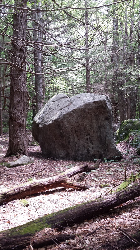
The glacier decided to drop this big boy right in the middle of the woods.  Okay, there were probably no woods then.

We returned to our car and headed down Grantville Road to the parking area we had passed earlier for Hurlbut Field.


There is a nice big sign at the entrance to the field, so you know you are in the right place.  There is also a kiosk with more information and trail maps available.


Park at the side of the road near the sign.

Follow the mown path through the field and go into the woods.  Before long you are on the shore of Winchester Lake.  But, don't be in too much of a hurry to get through the field.  The field was the highlight of our day.

So picturesque.  I wish I had more than the camera on my phone.  See the different colored ladder-back chairs on the side of the barn?
As we reached the top of the field, we saw some birds flying about and coming to rest on top of some of the taller plants in the meadow.  I had never seen this type of bird before, but I remember reading on the Land Trust's facebook page that there were Bobolinks nesting here.  Huh.  I always thought Bobolinks were like partridges.  No. No.  Those are Bobwhites!  The Bobolinks are song birds that, as it says on the Cornell Lab of Ornithology's website, look like they have their tuxedo on backward.  They are white on the back of their head and back and black on their wings and breasts.  That is what these were.  Sadly, they are just little black blurs in the pictures I took.

Foxglove?
One of the other fantastic things about this meadow was all of the milkweed.  Just look at it all!  We saw several different kinds of butterflies.  We think we might have seen a Monarch or Painted lady, Swallowtail, and a Fritillary (not sure which type).


Glorious milkweed!

Cow Vetch

Fritillary on Milkweed
After spending a little extra time enjoying all the meadow had to offer, we entered the woods.  This trail took us along the eastern shore of the lake and over to the dam.  There were several people fishing from the grass-covered dam, a few people getting ready to put their float tubes in the water at the boat launch, and another few already out on the water in their canoes and kayaks.


Winchester Lake
We spent a few minutes enjoying the view of the lake and looking at the wildflowers along the dam before heading back to the car.  You can make this hike into a loop hike if you want to do a road walk, but we returned the way we had come.  That gave us another chance to see the meadow.


Winchester Land Trust doesn't have a ton of property, but what they do have is quite diverse.  I especially recommend a visit to the Hurlbut Field property.  It has been several days, but I am still excited thinking about all that property had to offer.

2017 Hike #23: McLean Game Refuge - Granby, CT

Date Hiked: Sunday, June 25, 2017
Estimated distance:  1.35 miles
Weather: 78°F, scattered clouds
Resources: McLean Game Refuge, Trail Map
Highlights of the trip:  view of Spring Pond
Progress toward 2017 Outdoor Goals:  23/52 hikes; 77.62/250 miles hiked

Just a quick walk around the pond.


New signage.

Spring Pond

Saturday, June 24, 2017

2017 Hike #22: Horse Guard State Park and Found Land Recreation Area - Avon, CT

Date Hiked: Thursday, June 22, 2017
Estimated distance:  2.60 miles (1.11 miles Horse Guard SP, 1.49 Found Land)
Weather: 80°F, scattered clouds
Resources: Horse Guard State Park, OpenStreetMap, Found Land Trail Map
Highlights of the trip:  the view at Horse Guard SP
Progress toward 2017 Outdoor Goals:  22/52 hikes; 76.27/250 miles hiked


Last fall I read an article in the Hartford Courant by Peter Marteka about Horse Guard State Park in Avon, one of the "Other" state parks.  "Other" parks are the ones that, when you visit the DEEP website, are included in a long list of parks and forests with little information and no trail maps.  I think these parks tend to be ignored because of the lack of information.  Do not ignore this one.  For relatively little effort, the payoff is very good.

I parked at the Avon Historical Society's Derrin House, a little over a mile south of Route 44 on Route 167.  There is a trail sign at the edge of the lawn, and I took that as the location of the trail head.  Was it?  Maybe I missed another access point, because I was soon pushing through bushes and kicking myself for not having sprayed more than just my pant-legs with bug spray.


It looks like their might have been a loop trail, but David Reik's information on OpenStreetMap indicates much of it is a bushwhack.


I soon spotted the white blazes and was on my way.  Well, not for very long.  I passed a large tree trunk across the trail because I could see white blazes beyond it.  Right after the tree, the blazes indicated a right turn over a jumble of logs that I thought was there because the ground was wet.  I made my way across, but the trail didn't seem very well maintained.  Hmm.  Went back, found some white blazes that went to the left, but again the trail seemed very poorly maintained.  Let's start again.  I went back to the other side of the downed tree and easily spotted the trail leading off to the right.  I had not seen any blazes indicating a turn before the tree, but maybe I missed them.

I did not see a nest.  Not sure of the type of bird.
I continued to follow the trail through the forest and back and forth across areas with improvised log "bridges" put down to help navigate wet areas.  The hiking poles were definitely helpful in keeping my balance over the logs.  I came to a more open area and, off to my right, I could make out a talus slope through the trees.  I knew this is the area I wanted to climb to get the view.

Talus slope through the trees.

Hemlock Varnish Shelf

Talus slope.
There are no blazes up the talus slope, so you just have to pick your way.  I wound my way up to the top and kept following the trail until I came to an area that had a fire pit.  I went a little beyond that and out to a rock ledge with nearly 180 degree views to the west.  The panoramic shot spans that distance and includes Taine Mountain (southwest) to the left and Mount Horr (north-northwest) to the right.


There were quite a few wildflowers at the summit including Pink Corydalis, Spreading Dogbane, Blueberry, Rose (Virginia or Carolina, not sure which), and Venus's Looking Glass.

I thought this was in the Heath family, like blueberry, but nothing seems to match.  Could it be Spreading dogbane?

Blueberries.

Rose

Venus's Looking Glass.
I headed back and took in the view to the south.  This was the money shot as far as I was concerned.  The mountain with the radio towers is Rattlesnake Mountain, and to the right is West Peak, part of the Hanging Hills of Meriden.  Pretty spectacular.


When I got down near the parking area, I decided to take a shot of the "trail".  You can make out the red-sided Derrin house through  the foliage and that is basically where I had to cut through to get to my car.


The hike in Horse Guard State Park was only a little over a mile, so I had scouted ahead for another short hike to do while I was in Avon.  The town has some open space with trails, so I decided to give Found Land Recreation Area a try.  I parked in the cul-de-sac at the end of Saint Michael's Court where the sign is located.  There is a kiosk as you first enter, but there didn't appear to be a map on it.


I went in a clock-wise direction following the yellow blazes.  Then I came to a spot with a trail that went off to the left and there was a red blaze on a tree to my right.  Hmm.  I decided to go to the left a little way, just to see and noticed more red blazes and what looked to be boundary marker posts.  I got to the top of a small rise and saw another cul-de-sac.  I crossed the road and had a magnificent view of the Heublein Tower over on the Metacomet Ridge.

Heublein Tower on Metacomet Ridge in the distance.
I turned back around and went back to the trail intersection.  A red trail (not on the map) seemed to go off to my left.  I decided to go straight as I came back down from the road and saw the yellow blazes again.  I turned again and came to the remains of a stone wall.  Now I saw yellow blazes on my right and red ones on my left.  I decided these red blazes were marking the property rather than indicating a trail.  I came to other trail crossings and became more confused.  I knew there was a cutoff trail, and I purposely went by a trail (that I think was blazed yellow) because I thought that was the cutoff.  I reached a turn in the trail and assumed I had come to the place where the yellow trail starts heading back.  Now I am not so sure, because the outer loop was supposed to be over two miles and I ended up only covering about 1.5 miles.  Humph.  In the end, I didn't care.  It was hot and buggy, and while this is probably an okay place for walking your dog if you live in one of the really fancy houses in the neighborhood, it didn't have much to recommend it for other hikers.  Still, I am glad I checked it out.


I have no idea how this old Jeep made it down the trail and on to its roof.


So, check out Horse Guard State Park, but if you are looking for more mileage to add to that, Found Land is a bit of a let down.