Showing posts with label waterfalls. Show all posts

Sunday, June 16, 2019

Franconia Notch:The Basin and Cascade Brook - Lincoln, NH

Date Hiked: Sunday, June 9, 2019
Estimated distance:  1.45 miles
Weather: 68°F, fair
Resources: New England Waterfalls (book), (website), Franconia Notch State Park
Highlights of the trip: rock shapes smoothed by flowing water


Our week in the White Mountains was about to begin!  We arrived late in the afternoon on Sunday, June 9th.  After checking into our accommodation (The Village of Loon Mountain), we decided to get outside for a short hike.  Franconia Notch was only a few miles away and we could easily fit in a hike to The Basin before dinner.  (The Basin itself can't really be considered a hike, but we did go beyond that to look at Cascade Brook).


Look how clear the water is!


I love how the water has smoothed these rocks.


The Basin

Cascade Brook


View across the Notch.
It was nice to get out after several hours in the car on the way up.  Monday's weather is looking good for our planned hike to Arethusa Falls. 


Friday, February 22, 2019

Carpenter's and Old Beech Falls - West Granby, CT

Date Hiked: Sunday, January 27, 2019
Estimated distance:  3.76 miles
Weather: 33°F, cloudy
Resources: McLean Game Refuge, Trail Map
Highlights of the trip: two waterfalls


Today, my hiking partner joined me to see two waterfalls.  She had visited Carpenter's Falls with me once before, but I also took her to see another set of falls that I had "discovered" and named "Old Beech Falls".


My route from MapMyHike.


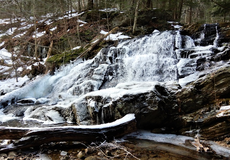
While many people may not think so, I think hiking in the winter can be one of the best times to hike.  There are no bugs and you are treated to sights you just can't see the rest of the year.  Look at some of the ice formations in the pictures below!  So cool! (Really, no pun intended.)


Carpenter's Falls is pretty easy to get to.  Just 3/4 of a mile up Broad Hill Road from the gate (near the Simsbury Road end).  A spectacular waterfall for relatively little effort.

Carpenter's Falls


After viewing Carpenter's Falls, we continued up Broad Hill Road past the cabin and pond (which are marked as private property on the map) and on to the Old Beech Road trail. [Note:  The old map says this trail is called Pine Cone trail.  The new map lists it as Old Beech Road trail and then the Pine Cone Trail goes off of that, farther west.]  We could hear the water in Beach Brook below us, and after a little bushwhack, we were at the falls.  Much more picturesque than I was able to capture in my photo.


Old Beech Falls

Monday, June 12, 2017

2017 Hike #20: Holcomb Farm to Carpenter Falls - West Granby, CT

Date Hiked: Thursday, June 1, 2017
Estimated distance:  4.52 miles
Weather: 75°F, partly cloudy
Resources: Holcomb Farm, Holcomb Farm Trail Map, McLean Game Refuge Trail Map
Highlights of the trip:  waterfall, snake, millipede
Progress toward 2017 Outdoor Goals:  20/52 hikes; 69.83/250 miles hiked

I should have waited a day to take this hike.  I ended up picking a warm, rather humid day and if I had waited one more day it would have dried out and there would have been a bit of a breeze.  Oh, well.  It was still a good hike.

I parked at Holcomb Farm in West Granby, went across the CSA fields and over the West Branch of Salmon Brook.  I took the Holcomb Trails to the orange, Northwest Passage Trail which comes out on Broad Hill Road.  From there, I took the dirt road to Carpenter Falls.  On the way back down, I zig-zagged my way down the Holcomb Farm Trails.


Bridge over West Branch of Salmon Brook.

Yellow trail leading to stairs.
Before I got to the stairs, I happened to see a couple of folding chairs in the woods.  I decided to walk over and take a look and see if there was some reason there were chairs sitting out here.  I have seen some crazy stuff in the woods, so you never know.  The craziest was a gorilla suit dressed up with blaze orange hunting vest and hat that my kids thought might be a dead body.  (What the heck?  I saw reference to it later in a geocaching post).  Nothing that strange this time, just chairs.  But, then I turned around...


Ugh.  I sure hope I wasn't caught on camera!  I may find out, because when I was hiking with my friend a few days later she said her son was one of the kids charged with taking care of the cameras at Holcomb Farm.  MH, please delete my picture!


Top of Carpenter Falls with plaque on rock.

Below the falls.


Falls are part of Beach Brook.

I hadn't initially noticed this jumble of boulders.

Looking downstream from the falls.

Common garter snake did not move when I got close.

Millipede.

Beach Brook near southern end of Holcomb trails before joining Salmon Brook.

Heading back across fields of Holcomb Farm CSA.


Saturday, June 3, 2017

2017 Hike #17: Keystone Arches Bridges and Glendale Falls - Middlefield, MA

Date Hiked: Sunday, May 7, 2017
Estimated distance:  4.87 miles
Weather: 50°F, overcast
Resources: Keystone Arches, Keystone Arch Bridges Trail, Trustees of Reservations-Glendale Falls
Highlights of the trip:  views of waterfalls and arches
Progress toward 2017 Outdoor Goals:  17/52 hikes; 55.94/250 miles hiked

In our continuing effort to visit new places, my hiking partner and I decided to hike at Keystone Arch Bridges Trail in Middlefield, MA.  As a bonus, we also went over to see nearby Glendale Falls, one of the Trustees of Reservations properties.


Keystone Arch Bridges Trail follows the Westfield River and offers views of the magnificent bridges built to carry freight trains.  Some interesting information from the Keystone Arch Bridges website:


While the West Branch of the Westfield River is the only one without a dam, that is not to say there are no grand earth and stone structures. Indeed, in terms of structure, the West Branch “rules.” Along its length sit the first keystone arch railroad bridges built in America. They are wholly dry laid, range in height to 70 feet and made possible the longest and highest railroad in the world, the Western Railroad, in 1840.

A lot more information is available on the website, including the fact that the bridges were designed by Major George Washington Whistler, father of the famed painter, James McNeill Whistler.

The parking area for the trail is just off Middlefield Road and there is room for a few cars.  We got our packs and poles and were just heading down the trail when we heard a rumbling sound.  A train!  Ugh.  We could just make it out through the trees.  I wish we could have been in a better place to view it.  The train, with what looked to be scrap metal and CSX cars, took awhile to go by.  We continued downhill and crossed a small bridge with views of a great little waterfall.


After leaving the waterfall, we soon came to a view of the Double Arch Bridge.  Very cool.  Too bad we hadn't been here when the train went by.


There were several places along the trail where streams make their way down to the the Westfield River.


Hobblebush?

Toothwort?
Where the trail turned away from the river, we came upon an old rock wall.  The map indicates an old artist colony in this area, I think.


The trail turned back to the river and we came to Keystone Bridge 'B'.  This bridge is no longer in use by the trains.  Breathtaking.  And I am not just referring to the stone work.  That bridge is high and there are absolutely no railings or other impediments to prevent you from going over the edge!  I cautiously approached the edge and looked down.  It was scary.  If I had young kids with me, I think I would have had them on a leash.


Keystone Bridge 'B'

A very poorly focused picture of Wild Red Columbine.


We reached the end of the trail and came out on to the train tracks.  We walked along them and found discarded spikes and other metal pieces used to attach the rails to the ties.


A car down over the rocks near the tracks.


After investigating along the tracks, we turned around and headed back.  This was definitely an interesting hike.

Purple trillium.  Also called wake-flower.


Pedestrian bridge.
As we neared the parking area, what did we hear?  Another train.  Are you kidding me?!  There were several places along the trail where we could have had a good view of the train, but our timing was off today. 

From the Keystone Arches, it is only five miles to Glendale Falls, so we figured we might as well head over there while we were in the area.  I am so glad we did!  There is not much of a hike there, but you can walk out and view the top of the falls and then follow the trail to the bottom of the falls.  Very impressive.


At the bottom of the falls, we met a mother and daughter duo and had a nice chat with them.  The mother lived in NYC and the daughter lived in the Boston area and they had met in Springfield and were out seeing the sites.  And this was the kicker.  The mother was about to turn 80!  Wow!  She was out there on the trail.  I hope I will have the mobility to be out on the trail at that age.

I am really enjoying checking out some of these new locations.  It is a reminder that there is still so much in this area that I haven't seen.