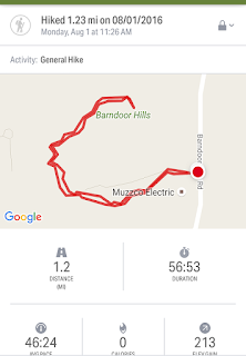
Estimated distance: 1.23 miles
Weather: 77°F, mostly cloudy
Resources: Granby Land Trust's Western Barndoor Hill Preserve Trail Map
Highlights of the trip: views from the top
Progress toward 2016 hiking goals: 39/52 hikes; 144.72/250 miles; 31.37/25 miles on Tunxis Trail
My son was interested in doing another hike. With me! What a nice kid. So far he has wanted to stick close to home. I think it is because he does not want to take the time to drive to anything too far away. Plus, he knows I am a slow hiker, so any hike with me will take awhile.
One of the things he has wanted to do is to hike from our house, through McLean Game Refuge, and up to the top of the Western Barndoor Hill. The game refuge map, does not show a trail leading to the parking area for the Western Barndoor Hill on Barndoor Hills Road, but I was pretty sure there was a way to get through. So, my suggestion was that we drive over to Barndoor Hills Road, climb the hill and then he could figure out a way back through the refuge. He was happy with that plan.
As mentioned above, the parking for the Western Barndoor Hill is located on Barndoor Hills Road, right across from Kettle Pond Lane. There is room for 2-3 cars at the side of the road.
We walked up Kettle Pond Lane to the clearly marked trail head on the left hand side of the road. The trail climbs steadily, but it is not difficult. It loops around the houses on Kettle Pond and you can also see houses on Black Oak Drive.
It was cooler today, but still seemed pretty humid. We had no trouble working up a sweat on this short hike and my son was lamenting the fact that we forgot to put on bug spray. I was fortunate to have him along, as he seemed to be the insect magnet.
The area at the top of the hill is quite pleasant. No real undergrowth, just grass and scattered trees. Unfortunately, I did not take a picture. (For pictures of the trail, see Steve Wood's CT Museum Quest website). The trail leads to an overlook which provides views to the Eastern Barndoor Hill in the game refuge and north to Manitook Mountain and even Mount Tom in Massachusetts.
 |
| Eastern Barndoor Hill |
 |
| Cool old cedar tree. |
The app took some getting used to in that things don't seem totally lined up with the direction your phone is pointing, but it was close enough to use the shape of the mountains to figure things out.
You can also use PeakFinder on your computer. I use it in combination with Google Maps. I drop a pin on my location on a peak to get coordinates. I type those into Peakfinder and then use the compass to face in the correct direction. Using Google Maps in 3D is cool, too. Get to the right location and then use 3D to tip the map and look off into the distance.
My son and I returned to the car where he put on some bug spray and headed off on a trail into the game refuge. The trail is not on the game refuge map, but he said he came out into the fields between Kettle Pond and Spring Pond and picked up the trail there. I headed into the center of town and then home and he came in the door not long after me. So, now he knows he can hike from our door to the Western Barndoor Hill. Next, he'll have to see if he can make it all the way to Holcomb Farm.


No comments:
Post a Comment