Sunday, June 16, 2019

Franconia Notch:The Basin and Cascade Brook - Lincoln, NH

Date Hiked: Sunday, June 9, 2019
Estimated distance:  1.45 miles
Weather: 68°F, fair
Resources: New England Waterfalls (book), (website), Franconia Notch State Park
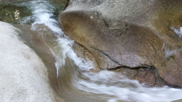
Highlights of the trip: rock shapes smoothed by flowing water


Our week in the White Mountains was about to begin!  We arrived late in the afternoon on Sunday, June 9th.  After checking into our accommodation (The Village of Loon Mountain), we decided to get outside for a short hike.  Franconia Notch was only a few miles away and we could easily fit in a hike to The Basin before dinner.  (The Basin itself can't really be considered a hike, but we did go beyond that to look at Cascade Brook).


Look how clear the water is!


I love how the water has smoothed these rocks.


The Basin

Cascade Brook


View across the Notch.
It was nice to get out after several hours in the car on the way up.  Monday's weather is looking good for our planned hike to Arethusa Falls. 


Friday, March 8, 2019

McLean Game Refuge - Granby, CT

Date Hiked: Saturday, February 16, 2019
Estimated distance:  3.07 miles
Weather: 36°F, fair
Resources: McLean Game Refuge, Trail Map
Highlights of the trip: beautiful sunshiny day, pileated woodpecker


I started at the Barndoor Hills Road entrance to the Game Refuge and walked toward Trout Pond.  On the return trip, I detoured on to the Werbitzkas Loop and came back along the West Branch of the Salmon Brook.  The trail conditions were a little tricky.  I wore my microspikes and used poles.  The microspikes weren't completely necessary, but the poles were quite helpful.


Cabin in the picnic grove

Basalt trap rock talus slope

Cabin at Trout Pond

This pileated woodpecker was in the tree as I headed toward Trout Pond and was still there on my return.  I spent quite awhile watching him and taking pictures and he seemed completely unperturbed.  Of course, he was above me by 20-30 feet, so I guess he had no worries.

Pileated woodpecker

Schiro Preserve from Werbitzkas Loop

West Branch Salmon Brook


Sunday, March 3, 2019

Scantic River - Enfield, CT

Date Hiked: Sunday, February 3, 2019
Estimated distance:  1.76 miles
Weather: 34°F, cloudy
Resources: Scantic River Watershed Association, Scantic River Linear Park (Enfield) Map
Highlights of the trip: walking along the river


I noticed the Scantic River Watershed Association was offering a game day Super Bowl hike and it seemed like a good idea to get out and get some exercise and fresh air before planting myself in front of the TV and eating chicken wings!

We met at the parking lot of Powder Hollow Brewery.  There were quiet a few of us, enough to divide into a couple of groups.  I got a chance to catch up with someone involved with the American River Heritage Commission that I had met at CT Trails day in 2018 on the Scantic River in East Windsor.  This is another reason why hiking with groups can be fun.  Getting to meet such nice people.


I know we stopped to look at the fish ladder, but with the number of people, I didn't get a real good look.  We continued along next to the river and got to hear a little of the history of the area.  I had worn my microspikes, but they really were unnecessary.  In fact, there was one little girl walking along in her sparkly, pink sneakers.  She didn't seem to be having any problems, but I have to imagine her feet were cold and probably a bit wet by the time we got back to the parking lot.


The weather wasn't perfect, but I enjoyed the hike and seeing some place I hadn't been to before.

Sunday, February 24, 2019

Connecticut 169 Club: #1 Ellington

Ellington, Tolland County, Connecticut

Date of visit:  Saturday, February 2, 2019

Places visited:
Hall Memorial Library
Oakridge Dairy
LuAnn's Bakery & Cafe
Crystal Lake
Hockanum River Trail
Ellington Farmer's Market at the Indian Valley YMCA
Cold Creek Tavern

After living in Connecticut for over 30 years, my husband and I have decided it is time to visit each of its 169 towns and cities.  This quest is being aided by the book Connecticut 169 Club: Your Passport and Guide to Exploring Connecticut by Martin Podskoch.  We do not expect to see everything that each town has to offer, but to do enough to get the flavor of the place.

We chose Ellington as our starting point for the simple reason that they had a fun event planned:  Mini Golf @the Library.  This was perfect because we had also decided that we should go to the library in each of the towns we visit and get our book stamped passport-style.
 

Map from Wikipedia


When we approached the library, it was clear that Mini Golf @the Library was THE event.  The parking lot was full and we circled back around and parked at the church across the street.  Hall Memorial Library is simply stunning.  A beautiful old building that has been married very well with a modern section.  The residents of Ellington are quite lucky to have such a large and beautiful library.

Hall Memorial Library


Things were quite busy when we arrived, so after paying for our putters and balls, we decided to start on "the back nine" or the upstairs holes.  There were 25 holes in all, each sponsored by a different local business.  The fanciest hole, and the one where you are guaranteed a hole-in-one, ran all the way down the stairs in the old part of the building.


After finishing play, we purchased some raffle tickets to enter the teacup auction.  All proceeds were going to support the Friends of the Library.  Then we went down to the basement and spent a few minutes in their used book store.  An excellent collection and I would love to go back.

Francie, our connection to all things Ellington, suggested we go take a look at Oakridge Dairy, the largest dairy in the state, and watch the cows being milked.  The dairy was not open to tours when we were there, but we could peek in the windows.


The dairy has a pretty cool 72-stall carousel for milking the cows.  The carousel revolved slowly and sometimes stopped, I assume to let a cow off or to let a cow on.  When a cow takes one of the empty bays, an employee must attach the milking equipment.  When the cow is done milking, the equipment automatically detaches.  I assume the cow gets off when it is done being milked and the carousel has rotated around to the position where she can step off.

Milking carousel.  You can see some cows are being milked and some are done.
Next stop was LuAnn's Bakery where we picked up cinnamon buns for the next day's breakfast.  Yum!


As you can see from the map at the top of the page, Ellington has a panhandle shape.  The panhandle area of Ellington is called Crystal Lake.  We headed over to check it out and found that there was an ice fishing tournament going on.


After Crystal Lake, we were headed to the Indian Valley YMCA, but we stopped to take a short walk on the Windemere Road section of the Hockanum River Trail. 


After our walk, we went to the YMCA to visit the Ellington Farmer's Market.  The market runs all year, but during the winter it is moved inside to the Y and is open every other week.  There was a good selection of products including dairy, meat, fish, sauces and spreads, and hand-made products.  We got a tasty peanut sauce to use on noodles (or it could be a dipping sauce).

Our final stop was Cold Creek Tavern.  The brewery itself is only used for production.  At the tavern we were able to have lunch.  Unfortunately, they had only one of their beers on tap and it was a style that my husband doesn't care for.  He ended up with a beer made by a non-Ellington brewer.  Oh, well.  Our lunch was tasty, and a good way to end our tour of Ellington.

One town done, 168 to go!


Friday, February 22, 2019

Carpenter's and Old Beech Falls - West Granby, CT

Date Hiked: Sunday, January 27, 2019
Estimated distance:  3.76 miles
Weather: 33°F, cloudy
Resources: McLean Game Refuge, Trail Map
Highlights of the trip: two waterfalls


Today, my hiking partner joined me to see two waterfalls.  She had visited Carpenter's Falls with me once before, but I also took her to see another set of falls that I had "discovered" and named "Old Beech Falls".


My route from MapMyHike.


While many people may not think so, I think hiking in the winter can be one of the best times to hike.  There are no bugs and you are treated to sights you just can't see the rest of the year.  Look at some of the ice formations in the pictures below!  So cool! (Really, no pun intended.)


Carpenter's Falls is pretty easy to get to.  Just 3/4 of a mile up Broad Hill Road from the gate (near the Simsbury Road end).  A spectacular waterfall for relatively little effort.

Carpenter's Falls


After viewing Carpenter's Falls, we continued up Broad Hill Road past the cabin and pond (which are marked as private property on the map) and on to the Old Beech Road trail. [Note:  The old map says this trail is called Pine Cone trail.  The new map lists it as Old Beech Road trail and then the Pine Cone Trail goes off of that, farther west.]  We could hear the water in Beach Brook below us, and after a little bushwhack, we were at the falls.  Much more picturesque than I was able to capture in my photo.


Old Beech Falls

Wednesday, February 20, 2019

East Granby Farms to Peak Mountain - East Granby, CT

Date Hiked: Saturday, January 26, 2019
Estimated distance:  2.31 miles
Weather: 30°F, partly cloudy
Resources: East Granby Land Trust
Highlights of the trip: nice views

This was a nice little hike with a group from East Granby Land Trust.  We started off with around 9 people at the north parking lot of the town-owned East Granby Farms Recreation Area.  Once we got into the woods and started climbing, the icy trail became a little treacherous for those without micro-spikes or something similar.  Several people had to turn back.  The rest of us were able to climb to the peak and look out to the west over the Farmington Valley.

Screenshot of route from MapMyHike

Looking south along Metacomet toward Heublein Tower

East Granby Farms


GLT's Seth and Lucy Holcombe Preserve - North Granby, CT

Date Hiked: Sunday, January 13, 2019
Estimated distance:  2.57 miles
Weather: 22°F, partly cloudy
Resources: Granby Land Trust, Seth and Lucy Holcombe Preserve Trail Map
Highlights of the trip: nice views


Screenshot of route using MapMyHike.