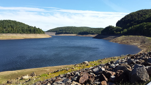
Wednesday, September 21, 2016

Hike #43: Peaked Mountain & Miller Forest - Monson, MA

Date Hiked: Saturday, September 17, 2016
Estimated distance: 2.75 miles Peaked Mountain Tract + 1.95 miles Miller Forest Tract
Weather: 72°F, sunny with high clouds
Resources: Trustees of Reservations - Peaked Mountain, Map
Highlights of the trip:  expansive views
Progress toward 2016 hiking goals:  43/52 hikes; 161.27/250 miles; 31.37/25 miles on Tunxis Trail


First, a pronunciation lesson.  My Pennsylvania-raised husband thinks Massachusetts has some crazy pronunciations (like he can talk - Uwchlan and Bala Cynwyd are but two examples).  He would cite Haverhill, Scituate, and the one that really sticks in my craw when they mispronounce it on TV, Concord.  However, in this case, I had to be corrected, too.

Monson is pronounced Munson and Peaked is pronounced Pea-kid.  Surprisingly, it is Monson that I have the harder time with.


But, enough of the lesson and on to the hike!

Trustees of Reservations Peaked Mountain Trail Map

I joined my friend and her geocaching husband for this trip.  I tried to get my husband to join us, but in the end, it was probably better that he didn't go, as he would have been sorely disappointed - not with the hike, but on missing out on getting any beer at Tree House Brewing.  I'll explain later.

As you can see from the map above, the Trustees Peaked Mountain property is divided into two tracts, both on Butler road about a mile apart.  We started with the more difficult Peaked Mountain Tract and then did the easier Miller Forest Tract.


There were quite a few cars in the parking lot for Peaked Mountain, but still plenty of room.  I would guess the parking lot could hold at least 20 cars.  Note:  No bathroom facilities at either location.  Not a problem for the many locals who walk their dogs here, but it would have been nice to have a port-a-potty for those of us who had traveled an hour to get here.

The trails are very well marked and, where they crossed, had a number and a trail map on a post indicating your location.  Nice.  We took the red trail, Roslyn's Turnpike, up to the West Rock Trail and turned right.  This is also blazed red and takes you around to the west-facing Valley View overlook that gives you a glimpse of Springfield in the distance.


Springfield just to the right of center.


The red trail is now called Valley View and starts to climb more steeply as it approaches the top of Peaked Mountain.


A little over one mile from the parking lot, you are treated to an absolutely spectacular view.  It is hard to tell in the picture below, but Mount Monadnock in New Hampshire was visible just to the left of where the tree pokes above the horizon.  We could also see Wachusett Mountain to the right, way in the distance.

Imagine this in the fall!


We had a nice chat with a couple from Boston who were interested in hearing about the geocaching that my friend's husband was doing.  I think he found most of the caches he was looking for today.

As you step from the viewpoint back into the woods, there is a nicely crafted little mailbox with a log book.  The book is completely full, so hopefully some kind soul will provide a new one.


We completed our hike of the Peaked Mountain Tract by going down Ruth's Mountain Trail (orange) and on to Orchard Trail and Skid Row back to Roslyn's Turnpike and our car.  This seems to be a popular place to hike, but I didn't find it too crowded even on this spectacular day.

We then drove north on Butler Road to the Miller Forest Tract.  This hike was shorter and flatter, but had a nice walk through the woods and around the pond.  It was very pretty.


We met what I assume were a father and son with their fishing poles.  The stream was pretty low, so they ended up having to go over to the pond.

Stream was pretty low.


I bet this is really pretty when the leaves turn.

After this hike, we headed over to Tree House Brewing arriving just moments too late.  When we got there, there were only eight 8-packs left, and there were more than eight people in line.  Not many more, but enough that we knew we were out of luck.  My husband would have been sorely disappointed to have been so close and miss out, so it was probably better that he hadn't joined us.  (They have a twitter account, but we had zero service where we were, so we had no way of knowing how much beer was left).

We went up the road to Westview Farms Creamery.  This is the place my friend picks her pumpkins.  I was looking at the fields.  They are full of weeds!  Tall weeds.  I asked and she said that that is part of the fun, hunting through the weeds, only your head visible to the others, as you find the perfect pumpkin.

The creamery seems to be popular for families with young children.  They have goats you can feed and a little play area.  In addition to ice cream, they also serve hamburgers, fries, and the like.  I did not have anything today, but I would think it would be a great place to grab an ice cream and sit and take in the absolutely tremendous view!

Little Monson has a lot to offer.  I will definitely be back!


Sunday, September 18, 2016

Hike #42: McLean Game Refuge - Granby, CT

Date Hiked: Monday, September 12, 2016
Estimated distance: 2.82 miles
Weather: 62°F, sunny
Resources: McLean Game Refuge
Highlights of the trip:  red eft
Progress toward 2016 hiking goals:  42/52 hikes; 156.57/250 miles; 31.37/25 miles on Tunxis Trail


It was a beautiful day and I wanted to get out.  I had thought about going back to Colebrook River Lake, but my hiking partner wasn't able to go.  I decided to go to the McLean Game Refuge.  This is a hike I do a lot (see the sidebar for labels), but there is always something new to see.


Upon arriving at the mostly-dry Kettle Pond, I walked out to take a closer look.  I found a plant I hadn't noticed before with strange spiky seed pods.  Based on some searches on the internet, it seems to be some kind of sedge.  (I have a rather large collection of field guides, but not one for grasses and sedges it seems.)


Sedge of some sort.

Kettle "Pond"
The area also has a lot of bright red Cardinal flowers.

Cardinal flower

When I turned back around to get back on the trail, I was greeted by a red eft sunning itself on a log.  A red eft is the juvenile stage of the eastern newt.  While the adult stage is aquatic, this juvenile stage, which may last up to four years, is terrestrial.


After saying goodbye to my little red buddy,  I got back on the trail toward Spring Pond.

I am going to guess Rag-veil Amanita.
Spring Pond, as the name suggests, is spring fed, so it still has water.  I saw quite a few turtles out on the logs, but the camera on my phone is not good enough to zoom in and get a clear picture.  Most of the turtles are Eastern painted turtles.  I have seen a snapping turtle in the water here, but never sunning.


Spring Pond


 A nice hike on a beautiful day.

Thursday, September 15, 2016

Hike #41: Colebrook River Lake (Yes, Lake!), - Colebrook, CT

Date Hiked: Sunday, September 11, 2016
Estimated distance: 2.77 miles
Weather: 79°F, scattered clouds
Resources: Peter Marteka's Article in Hartford Courant:  The Ghost Bridge and Highway of Colebrook River Lake (pub. 09/11/2016)
Highlights of the trip:  bridge and road normally covered by water
Progress toward 2016 hiking goals:  41/52 hikes; 153.75/250 miles; 31.37/25 miles on Tunxis Trail


When I saw Peter Marteka's article in the Hartford Courant on Sunday, I knew where I was going to go on my next hike.  Colebrook River Lake is the body of water north of the West Branch Reservoir, where my hiking partner and I kayaked in my last post.  She wasn't available today, but my husband was nice enough to indulge me after returning from his golf outing.


The funny thing is that, in my last post, my app makes it look like we kayaked over dry land.  This time it makes it look like we walked on water!


Colebrook River Lake Boat Launch on Google Maps

Above is an image from Google Maps that shows the "normal" water level.  See the area I marked as "Old Road"?  The picture below shows people driving on the "Old Road".  Crazy!  (Although I read somewhere - can't remember where - that the water level may be lowered at certain times of year, for flood control, and that you may be able to access the road then.)


Old road on left and end of boat ramp on right.  Picture taken from the boat launch parking area.


Barricades up in front of boat launch for obvious reasons.


Looking south toward the dam from the boat launch parking area.

We could have driven down the old road to see the bridge that Marteka mentioned in his article, but we decided to walk.  It was an absolutely gorgeous day and it seemed to be a better way to really grasp how low the water level really is.

Old road headed north from parking area toward bridge.


The picture above was taken from the old road looking down on the iron bridge.  The water would not normally cover the road here, but it would come up much closer to the trees.

Google maps image of the area where the bridge is.  You can see the road in this area is not usually under water.


Looking north.

Looking north.  Tree stumps that remain from when the land was cleared to make way for the lake.

If I understand the history properly, the MDC started buying up property along the West Branch of the Farmington River in the 1930's.  By 1955, construction of the Goodwin Dam, at the southern end of the West Branch (Hogback) Reservoir, was complete and the planning for the Colebrook River Dam began.  So, they basically divided the reservoir into two parts.  You can read more about the history of the dam at the Colebrook Historical Society website and at the U.S. Army Corps of Engineers website.


Harvey Mountain Bridge with the West Branch flowing beneath.

When we went on Sunday, we were still free to cross the bridge and walk around on the other side. It now seems that officials have closed the bridge.  (Quite unlike our trip to Ireland last year where we climbed an old bunker that had decrepit steps and glass all around with no warnings at all.  I guess they just expect you to use your head and/or not sue if you manage to hurt yourself.  Personal responsibility - novel).


On the far side of the bridge, we saw large areas of mud flats and old stone walls.  It's a little hard to comprehend that there was a town here.  We did not spend a lot of time looking, but I did find a rusted piece of metal on the ground.  Check out this picture from Demarsimages.com.

The flooding of this town, Colebrook River, is not unique.  Barkhamsted Hollow and Hartland Hollow were both flooded for the Barkhamsted Reservoir and four towns were flooded for the Quabbin Reservoir in Massachusetts.  The Hartford Courant article by David K. Leff, History Submerged: Clues to World Beneath Connecticut's Reservoirs is worth reading.  (I also love the children's book Letting Swift River Go by Jane Yolen about the drowning of the towns for Quabbin).


Looking south.


Bridge we crossed.
We walked back to the parking lot and then drove down the normally submerged road toward the dam.  It looked like there was another area that used to be used as a boat launch down this way.  Although the road seemed to continue, I was not sure it was still paved, so we decided to turn around.

I am so glad we grabbed the opportunity to visit the lake while we were still allowed to cross the bridge.  You may be able to access the other side from Harvey Mountain Road or Colebrook River Road, but I have not tried it.

Colebrook River Dam.


Here is a very cool video shot recently by a drone.  Colebrook River Lake, Aerial Video Journey of Low Waters by Addy Overbeeke.  When he turns the drone around and heads south, you will see the road and the bridge - all normally covered by water.  This is not something that happened just over the course of this year.  I found someone's blog, that had a picture of the top half of the bridge showing in 2010 and she said people were able to walk across it in 2009.  In 2012, the water level was up and only the top of the bridge was showing.  In 2015, the water level only came up to the bottom girder of the bridge.  So there has been some fluctuation in the water level, but it sounds like it has been quite awhile since the lake was full.