Thursday, September 26, 2013

Barkhamsted: Tunxis Trail - Ratlum Road South

Date Hiked: Saturday, September 21, 2013
Estimated distance: 3+ miles
Weather: sunny, cloudy, rainy (it's New England), 74°F
Resources: CT Walk Book West, CTMuseumQuest
Highlights of the trip:  view of Lake McDonough, catching up with a friend


On Saturday, I was casting about for a place to go hiking.  I wanted to try this hike on the Tunxis Trail, but my usual hiking companion was busy.  I don't mind hiking alone, but I would prefer to do it with someone else when it is an area I haven't been before.  I had resigned myself to a hike in McLean Game Refuge (which is very nice, but I go there a lot), when I received a call from my oldest and dearest friend.  Her husband was busy and she wondered if I wanted to go for a hike.  Perfect!

We drove over to Ratlum Road in Barkhamsted and left her car in the parking lot at Ski Sundown.  Sundown was having a brewfest at 4 p.m., but it was 12:30 and we figured we'd be done well before the crowd arrived.  We drove north on Ratlum to just before its intersection with 219 and parked in a little lot there to start our hike.

We started climbing and before too long came to the first overlook.  From here there was a somewhat obstructed view of the Barkhamsted Reservoir.


It was a nice ramble through the woods.  Some areas were a little muddy and are probably not very pleasant to pass in the spring.  At some point we came across the marker pictured below.  I believe the H.W.W. stands for Hartford Water Works.  I am not sure about the numbers.  I thought 1820 was the date, but from what I can tell, HWW didn't form for another 35 years.

This whole idea of creating large reservoirs by damming rivers and drowning towns has always intrigued me.  The Quabbin Reservoir, in my native Massachusetts, drowned four towns in the 1930's.  How can the powers-that-be do this, and what happens to the poor people that lose their homes?  The Barkhamsted Reservoir drowned two villages, Hartland Hollow and Barkhamsted Hollow.  After seeing a comment on Steve Wood's website, CTMuseumQuest, I have taken the book Water for Hartford by Kevin Murphy out of the library to get some more background.


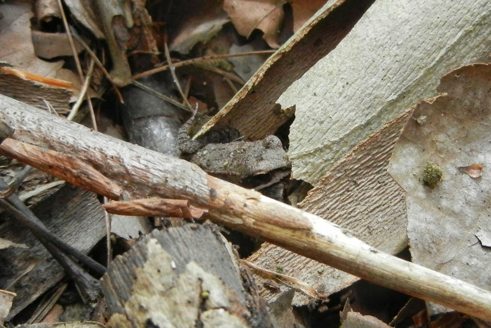
Onward.  It turns out I am not alone in my fascination with mushrooms.  We made quite a few stops to take pictures of what we found.

Not sure.

Spindle-shaped yellow coral?

Signed the trail log.
Somewhere along the way we had donned our raincoats, but the sun came out just as we got to the lookout over Lake McDonough.  At the far end of the lake is Richards Corner Dam.

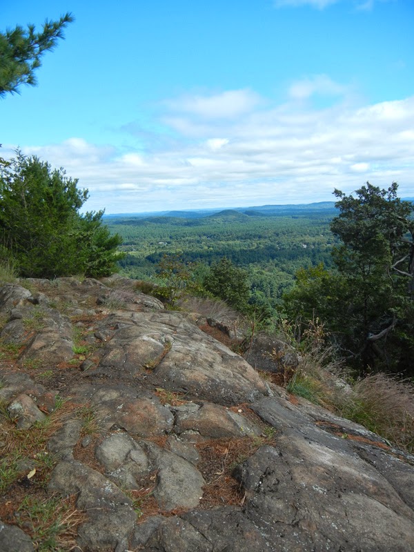
The view of Lake McDonough was fantastic.
I knew from my map, we were close to the end of our hike.  I do think that going from north to south on the trail might be easier (or maybe I was just distracted having someone to talk to).

We made it back to Sundown just as the brewfest was getting underway.  A beer might have been a nice way to end the hike, but it would have been a pretty expensive beer.  I think the tickets were around $30.


This was a great hike, made even better by having a friend along. 

Wednesday, September 25, 2013

Barkhamstead: Peoples SF - Elliot Bronson & Walt Landgraf Trails

Date Hiked:  Sunday, September 15, 2013
Estimated distance round-trip:  3.8 miles
Weather:  71°F, sunny
Resources:  American Legion and Peoples State Forests, CTMuseumQuest
Highlights of the trip:  Indian Caves

I had never hiked the Elliot Bronson or Walt Landgraf trails, so today was the day.  I parked off Greenwoods Road and hiked over the top of Ragged Mountain to the Walt Landgraf trail.  There are really no views along the Elliot Bronson trail, so it is not a hike I will likely make again, but I am glad I did it.  The Walt Landgraf Trail contains the Indian Caves.  I only wish Walt, former curator of the Stone Museum (now called the Peoples State Forest Nature Museum), could have been there to tell me all about them.  I really regret never attending one of his talks.

Indian caves.

One of several swampy areas near the top of Ragged Mountain.

I had hoped to visit the Stone Museum upon finishing the hike, but I was already past the time I had told my family I would return.  It's on the list for another day.


Simsbury: Hedgehog Mountain and Bog Trail

Date Hiked:  Saturday, September 14, 2013
Estimated distance round-trip: 1.5 miles in total
Weather: 67°F, beautiful and sunny
Resources:  Simsbury Land Trust
Highlights of the trip:  Views, beautiful fall colors already appearing in the bog


With a month to go before a hike up Mount Cardigan in New Hampshire, I've been trying to find some places locally that I can hike that will challenge me.  The elevation gain at Cardigan is nearly 2000 feet, and I am just not going to find that in Connecticut.  Today, I chose Hedgehog Mountain in West Simsbury.

I parked at the end of North Saddle Ridge Drive and took the white trail up along the stream and turned left onto the red trail which climbs to the top of Hedgehog Mountain.  I know this is nothing compared to what I am going to find in NH, so I decided to hike without stopping until I got to the overlook.  (That's a big deal for me.)  I think this view of the Farmington Valley is the best around.  It offers a whole different perspective than the one you get from the Metcamet Ridge on the other side.

Looking north.

Looking east.  That is the bog in the center.
On the way down, I stopped to take a few pictures.

Comon Polypody fern.


I returned to my car and drove just a short distance back down North Saddle Ridge Drive to the marker for the Bog Walk.  A short walk through the woods brought me to a boardwalk into the bog.  The colors were fantastic.


Looking at the ridge of Hedgehog Mountain.

Love the puffs of white cotton-grass in this photo.

After all the color of the bog,
the photo of the trail along the esker looks black & white.


Granby: McLean Game Refuge

Date Hiked: Sunday, September 8, 2013
Estimated distance round-trip:
Weather: windy, 78°F
Resources: McLean Game Refuge
Highlights of the trip: view

My Route:
I entered the McLean Game Refuge from the entrance on Canton Road and went down past Spring Pond.  From there, I went up and around the field and down to Kettle Pond.  When I reached the woods road, I turned left and took the trail to the top of the eastern Barndoor Hill.  I returned the same way.


A little family of mushrooms.  I welcome identification.
The water level in Kettle Pond is pretty low and I could walk out onto an area often underwater.  Here I spotted a wood frog and a large black spider guarding a tunnel in the grass.

Wood frog.  These guys come out in the spring when there is still ice on the pond.

Big black spider with what looks like a lair.
It was pretty breezy when I got to the top of the hill.  I was hoping to see some hawks, but didn't have any luck.  I had been up here a couple of days previously and saw some turkey vultures soaring.  Later, as I parted some branches to see about moving to another bit of ledge, I found a turkey vulture looking back at me, probably 10 or 15 feet away.  Of course, I didn't have my camera with me that day!

Looking north from the eastern Barndoor Hill.

Looking over at the western Barndoor Hill.

Field full of goldenrod.

Water lily at Spring Pond.

Pickerel frog.


Tuesday, September 24, 2013

Salisbury: Kayaking on Twin Lakes

I forgot to post this back in May.  My friend, Lori, has a cabin in Salisbury on Twin Lakes.  She invited me to go out and go kayaking with her.  It was a beautiful day.


We paddled along the shoreline and were able to get pretty close to a Great Blue Heron. 


We watched the kids from Salisbury School out practicing rowing and paddled our way down to the area between the two lakes.  It is really shallow here and a couple in a small motor boat that had come through, but then got themselves in a bind.  There was a bit of that testiness that sometimes happens between spouses that was a little embarrassing to be witness to, but we've all been there.  We offered to pull them if needed and commiserated a bit to try and lighten the mood.  In the end, they managed to free themselves and were off.

We went briefly into the "twin" lake.  It is much larger and deeper than the one we came from and would be worth exploring on another day.